
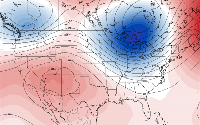
We are experiencing highs in the low 90s currently for many locations, and we will continue to do so. We cannot rule out a day or two in the mid 90s, especially for the coast and eastern NC/SC over the next 7 days. But that is all. Upper 90s are NOT looking likely at this point, at least into the 18th, which is the below model image for our upper air pattern.
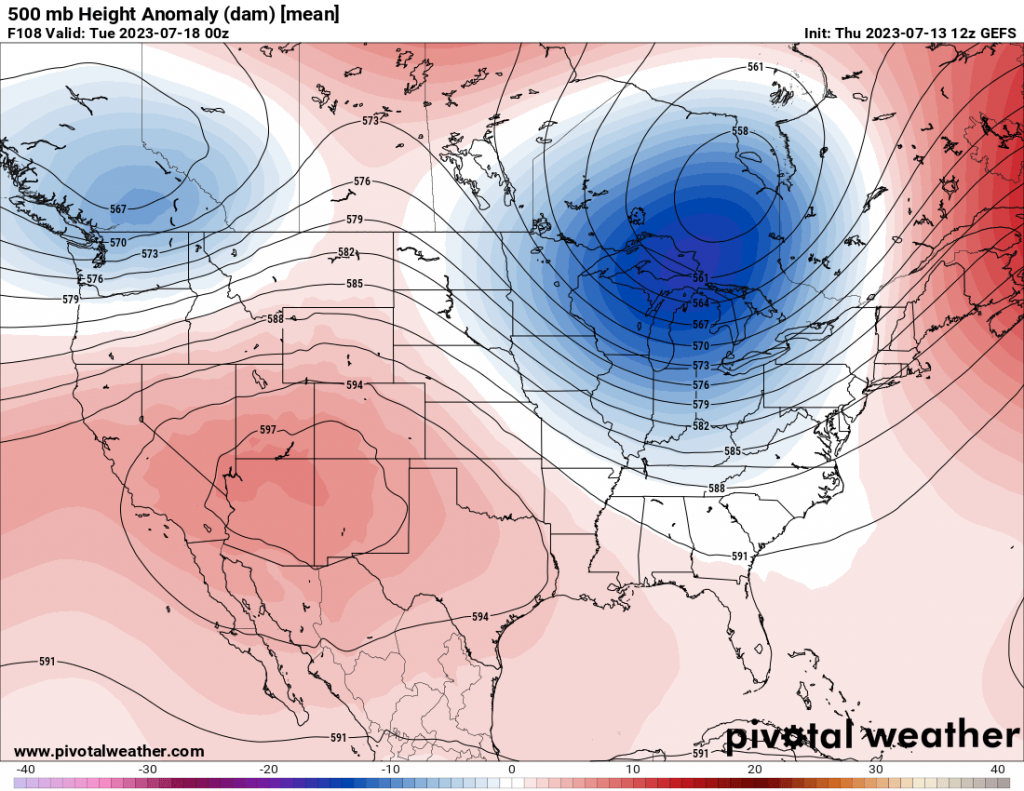
The jet stream will be taking a dip across the Southeast US, which is a sign of near normal temperatures for July. The Great Lakes will experience below normal temps. This also means that we could remain a bit unsettled, with showers and storms with each passing cold front.
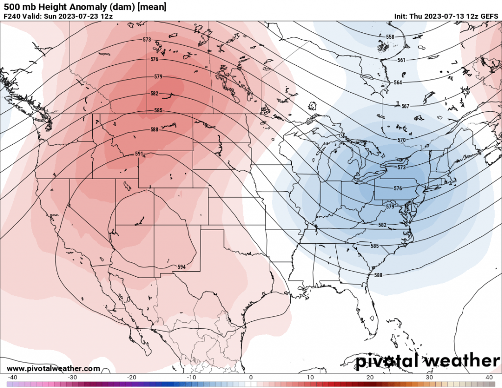
As we head into the 23rd, more good news for heat haters. An upper-level trough will swing through the Northeast, and could bring a day of below normal temperatures (below image). This trend may very well persist into late July,
Most of the heat, or heat dome, is looking to park itself out West over the Four Corners. Texas will also be affected by the heat.
Good news for us, expect a typical July but nothing crazy. And we could even cool off at times.
Please share this article with family and friends if you enjoyed reading!
You must be logged in to post a comment.