
There is a lot of chatter about some kind of tropical disturbance in the Gulf next week, however ensembles are not showing it just yet. We are not going to hop on the single deterministic model train and try to stir up fear when there is no reason to. We are not forecasting any kind of tropical system.
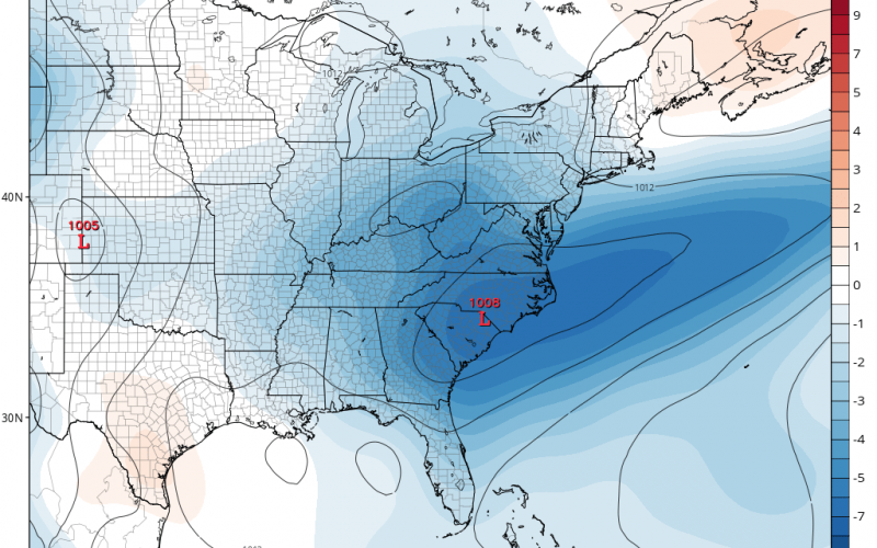
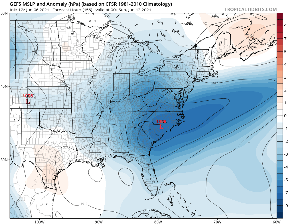
This week looks to be seasonably hot and humid, but then some changes come around Thursday as far as slightly cooler temperatures. Next weekend is looking cool and stormy according to the latest GEFS ensemble. Notice there is nothing in the Gulf. But there is a wave of low pressure that tries to develop over the Carolinas.
What does this mean for us? Each day this week has the potential for late-afternoon pop-up showers and storms. So be aware of lightning especially if you’re outside. Shown below are the total rain amounts, which will be heaviest to our west. But from late Thursday into late Sunday, it appears low pressure will bring us rain. There could even be some wind and waves along the coast as the system gets cranking.
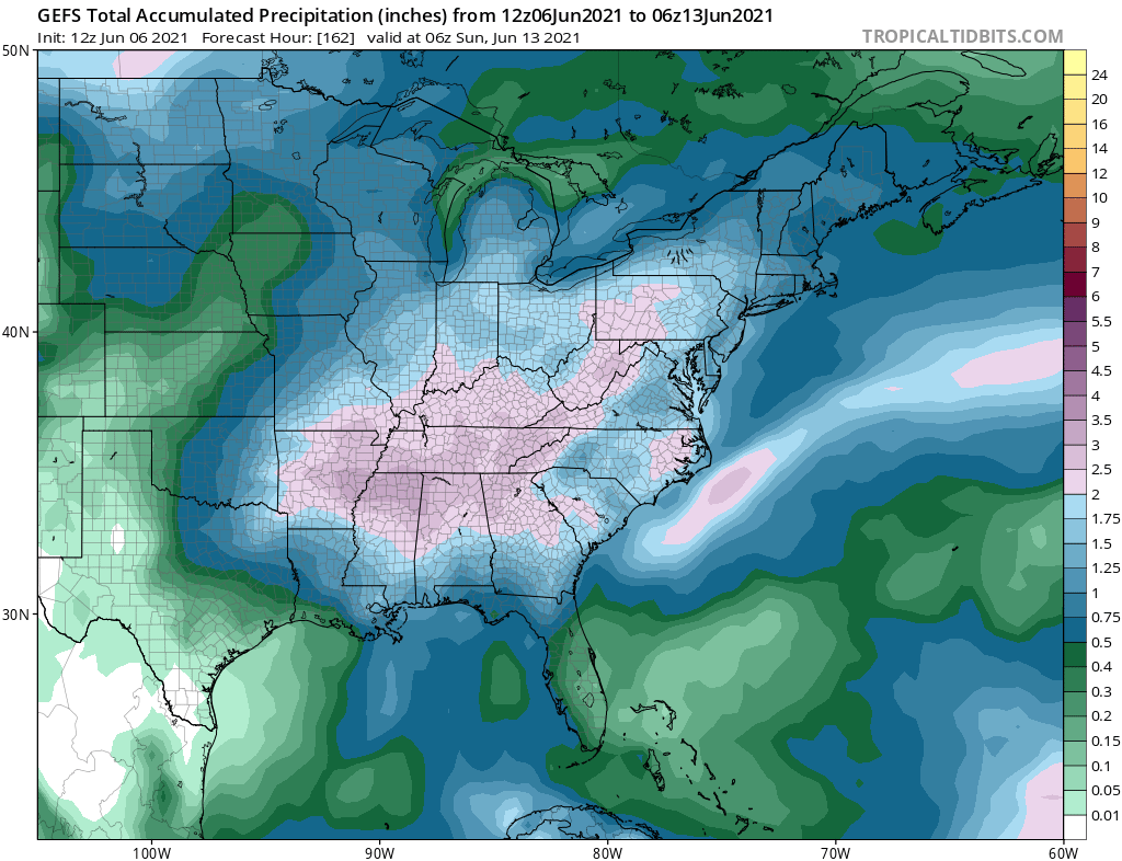
This does NOT look to be related to any type of tropical system. But nonetheless, one could form just off the Carolina coast as it did last year. We would not expect anything major, possibly just a 25-34 mph tropical depression. Check out the purple in the model graphic above. This could be rain from a coastal low as it strengthens and moves out to sea.
You heard it here first. Please do us a favor and share this article!
You must be logged in to post a comment.