
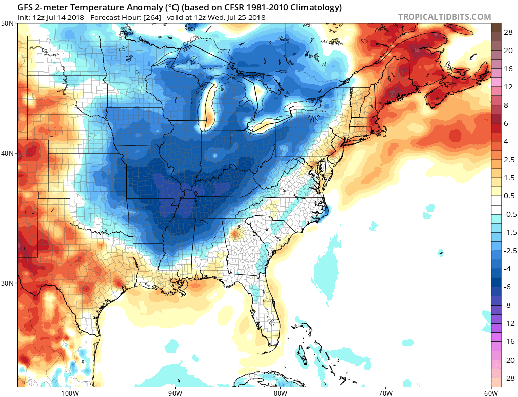
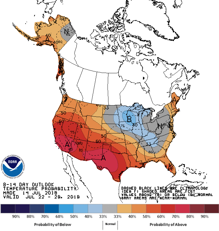
The rest of July may be a bit cooler than average, and that is looking like the case from NOAA CPC. Temperatures from now until July 25th are looking below normal.
The 8-10 day temperature outlook is signaling an East Coast trough in the pattern, which will keep things cool and stormy. From the Upper Midwest to North Georgia temperature trends are expected to be slightly below normal. This does not mean cold temperatures, it just means slightly below normal for this time of year.
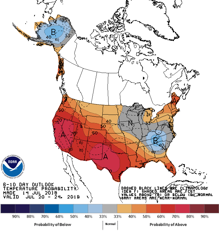
In the closer range, the 6-10 day outlook is calling for near normal and also below normal temperatures for the Southeast. This is valid from July 20-24th. Lower humidity and heat are more likely, however it won’t feel cold outside. Humidity levels may temporarily increase after it rains, which will be common in the Southeast.
The good news is that energy consumption should be on the average side or below average, which may save residents and businesses from high a/c bills.
Keep it tuned right here to East Coast Weather Authority for all the latest long-range updates!
You must be logged in to post a comment.