
We are entering a trough pattern here in the East, which is when the jet stream dips to the south. As a result, we can expect a stomier and wetter pattern. Temperatures will be on the cooler side, but it’s still July and it will feel hot at times.
The main concern is flooding, especially along the East Coast. The GFS accumulated precipitation between now and July 31st is shown:
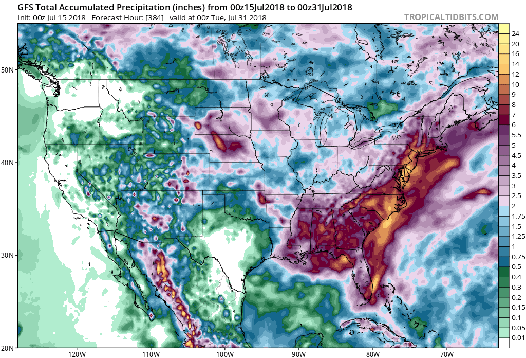
Rainfall amounts in excess of 10 inches are possible across NC, and these totals could make their way into the Delmarva, NJ, and eastern PA. Deep moisture will surge from the Gulf Coast all the way up the East Coast over the next 2 weeks.
Lawns will grow like crazy, but it will be hard to cut the grass during the almost frequent rain and showers. Plan for rain delays during any outdoor events.
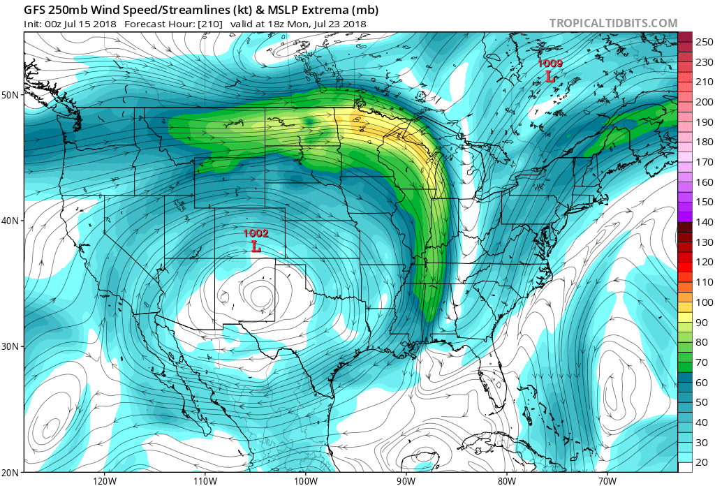
The western US will bake with extreme heat. Texas and the Four Corners are some of the areas that could hit triple digit heat. The jet stream will dip sharply over the East Coast, and as a result moisture will stream up from the Gulf. Notice the upper-air arrows indicating the general flow direction aloft.
Be ready for thunderstorms at first, and then downpours on the days that follow. We will keep you updated during the event so make sure you check back on our blog: https://carolinawxauthority.com !
You must be logged in to post a comment.