
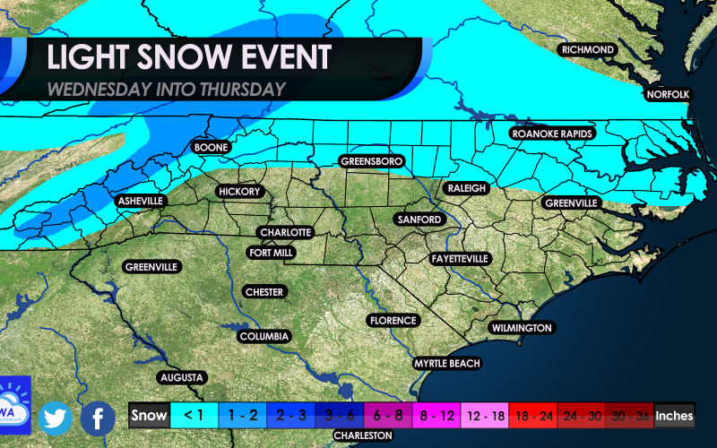
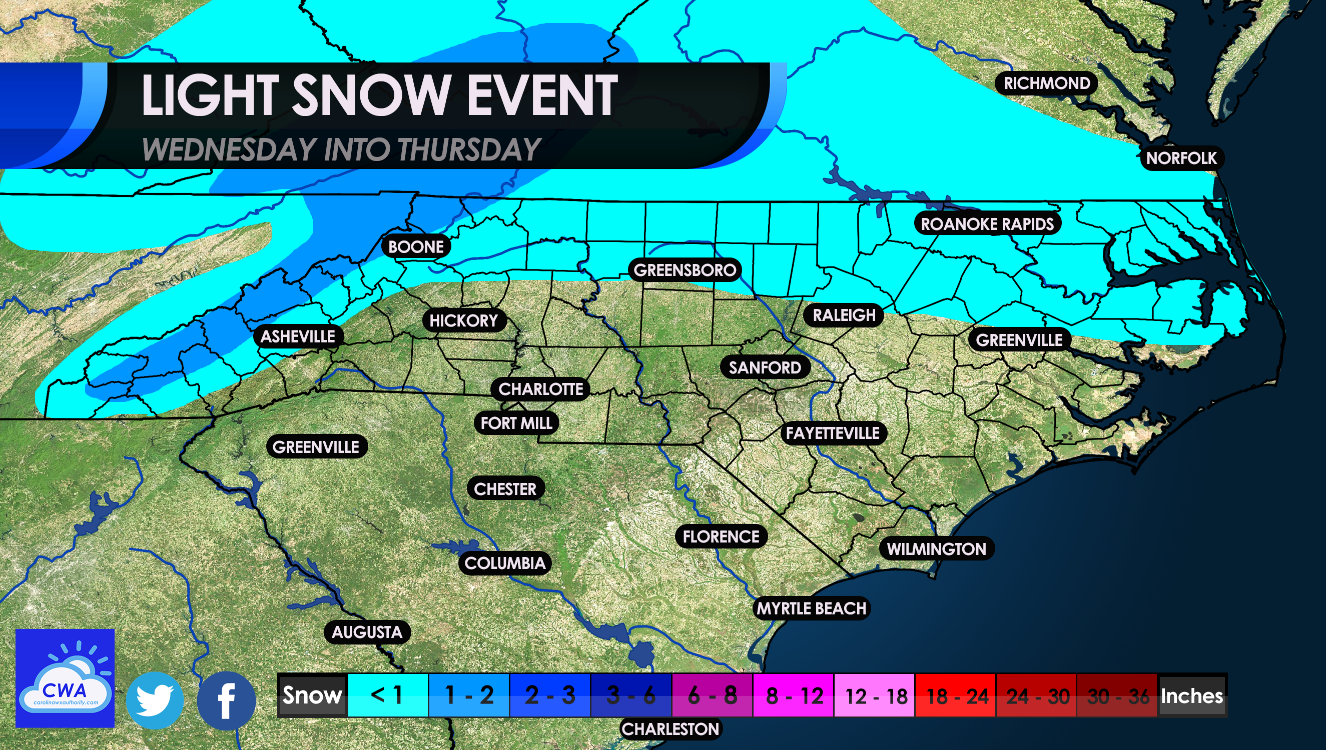
Happy Midweek! If you’ve made it this far you’re not doing too bad! Alright so lets talk about what all the buzz is for Wednesday night into Thursday. First of all, we are NOT expecting a major winter storm, bur rather mostly a cold rain that could have some flakes mixed in. Now, farther north across the NC and VA border we are looking at perhaps a bit more snow, but overall less than 1 inch. The best bet to see any accumulations are in the mountains. The exciting part is that eastern NC and southeast VA could be seeing a dusting or whitening of the ground, however any location could pop a total up to 2 inches.
Below is what are our thinking for our upcoming wintry event:
TIMING:
The timing of this event will be Wednesday night after midnight and into the early morning hours on Thursday. If you wake up late on Thursday, you may miss what stuck overnight. By lunchtime Thursday the storm will be long gone, and it will turn windy. Blustery conditions with gusts up to 30-40 mph are possible especially closer to the coast.
Below are the official expected wind gusts Thursday afternoon in mph:
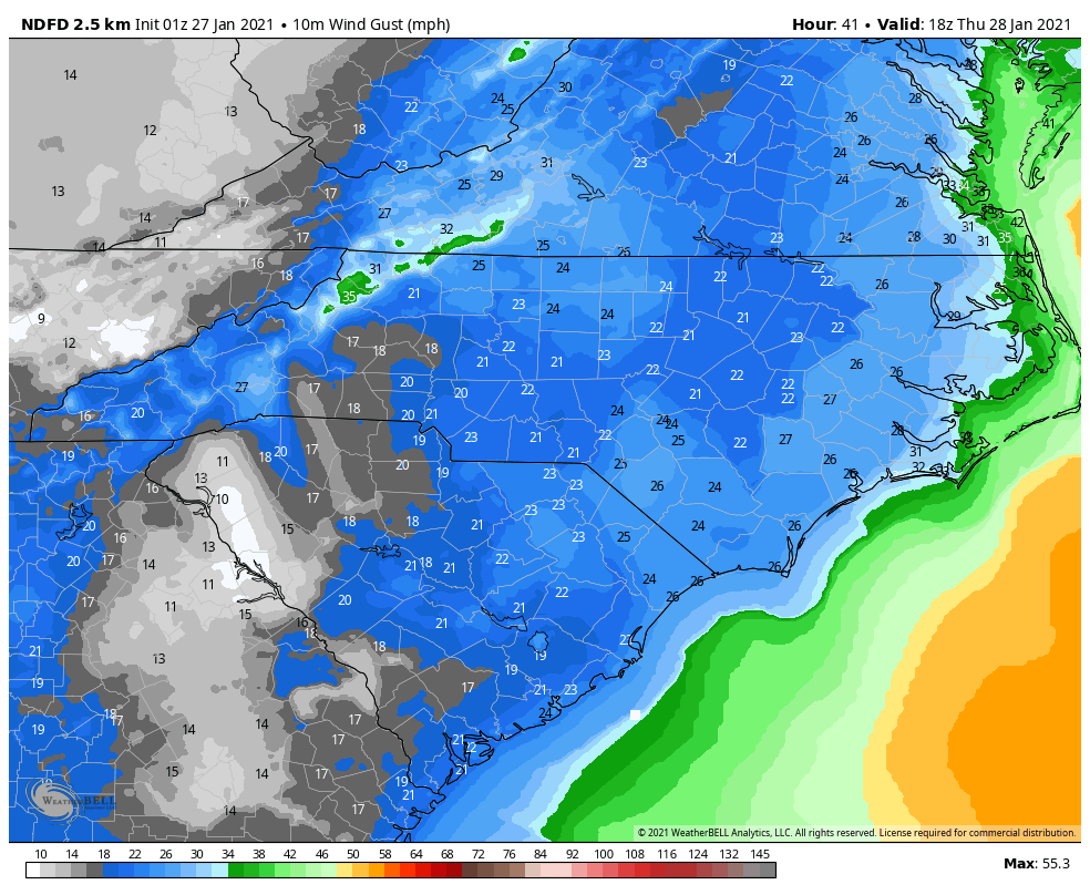
The mountains of NC could see the highest gusts especially locations like Boone and Blowing Rock. There could be some power outages and the storm exits so make sure to charge your phones!
This is NOT expected to be a major event snow-wise! Everyone please stay safe and enjoy.
You must be logged in to post a comment.