
If you’re looking for a break from this persistent early-season heatwave, our forecast modeling is indicative that this is indeed on the way for the Southeast.
Ensembles show a break down of the ridge as we start heading into this weekend and especially by next week with more of a trough setting up over the eastern half of the nation.
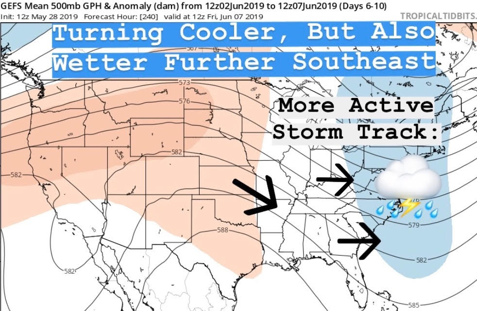
Our flow will become more northwesterly, meaning that disturbances bringing showers and thunderstorms will become more frequent for much of the south and east. This will likely drive down our daytime maximum temperatures as much as 10-20 degrees below what they have been this week. There may also be a slight decrease in nighttime lows for some of you. However, we may also see an increase in humidity levels some days based off the wetter trend in the pattern.
Severe weather will be something to watch for, as northwesterly flow setups can occasionally bring strong thunderstorm complexes to the South and Mid-Atlantic. However, there are no specific threats determined at this time . Just be aware of this in the days ahead.
It is also uncertain how long this exact pattern may last, but it should be predominant for at least the first week to 10 days of June, if not longer. Stay tuned in the days ahead!
Shown is your 5-day average 500 millibar height anomaly for the 2nd of June through the 7th of June showing the trough in the jet stream.
-Jesse
East Coast Weather Authority
You must be logged in to post a comment.