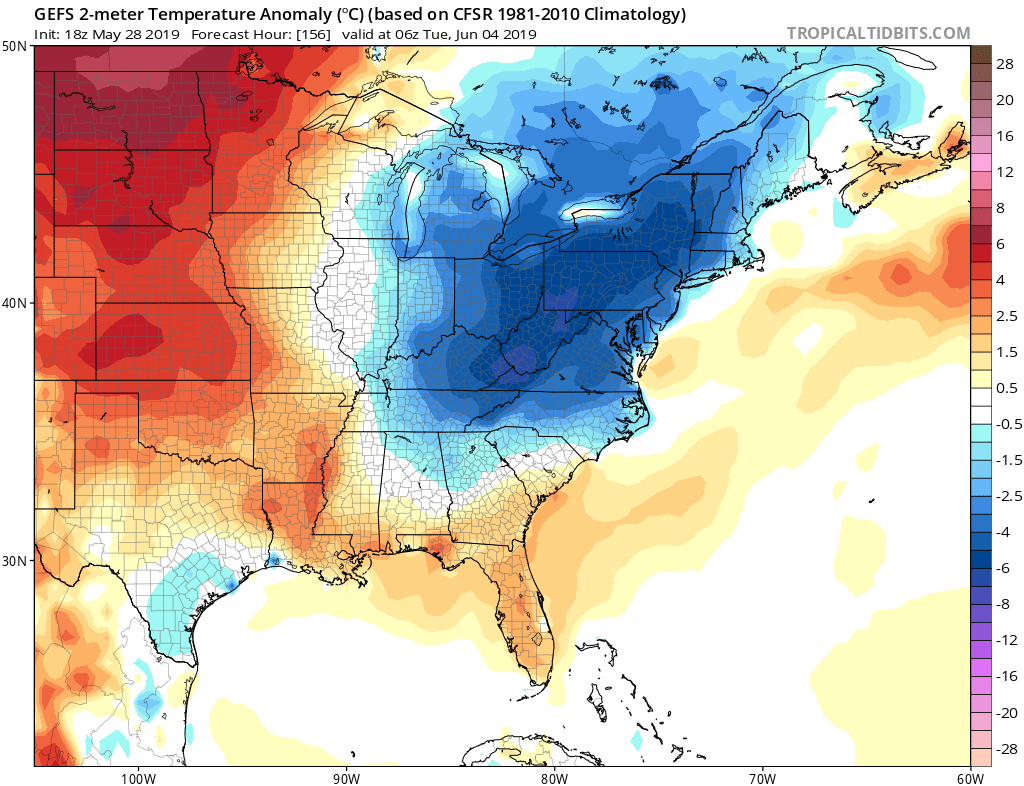
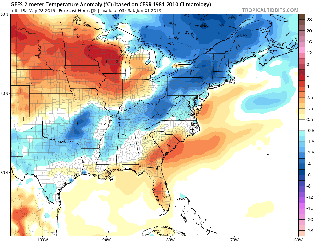
If you are not a fan of the heat, hang in there, because this weekend the heat will not be as intense. A more active pattern is shaping up for the Southeast in the form of showers and thunderstorms, some of which could be severe. However, our confidence for the severity level is low. Shown below is next Monday into Tuesday, and the “heat dome” will be non-existent over our region. A/C units will finally catch a break.
The first indication of backdoor cold front comes on Friday night into Saturday. The front will approach from our west into the mountains. Below normal temperatures are expected there through early Saturday morning. This could be in the form of rain, showers, or even storms. But the upper-level ridge will finally break down.
Hit the share button below if you are excited to see relief from the heat on the way!
-ECWA


You must be logged in to post a comment.