

We did make some posts on above normal temperatures through New Year’s, and that will likely be the case at least into the first week of January. But after that we are seeing a potential pattern change as we have discussed in a previous article. But now we are seeing something that could be slightly growing our confidence for the cold moving in around January 7th.
The Euro, Canadian, and GEFS ensembles are all pointing to East Coast cold around this timeframe.
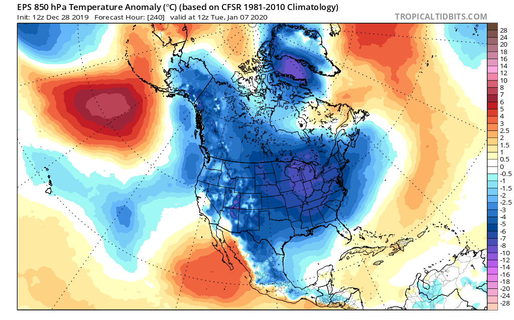
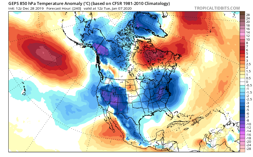

This is a sudden shift from previous signals which were either mixed or showing warm. This does not guarantee snow, it simply means, for now, that our above-normal temperatures will be erased. This is not an extreme cold signal, but rather just below average. But time will tell as we get closer to the 7th. The Euro is showing deep cold, and that could be the extremely cold air in Alaska that will spill our way. It won’t be as cold as it was there, but the cold air needs somewhere to go, and we could be the recipients.
-CWA
You must be logged in to post a comment.