
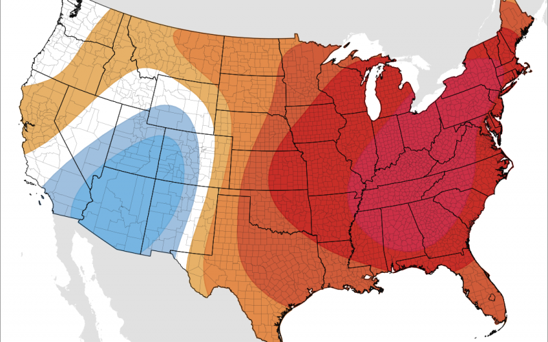
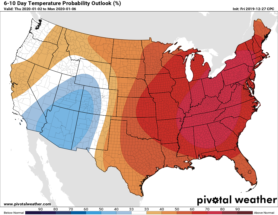
After a warm Christmas, many of us are wondering will the entire winter be above normal and snowless? Given that we are only 7 days into winter, we still have plenty of winter left. Long-range modeling during the winter months can also be atrocious. What we have to watch for in the 10-day timeframe are trends. Is something trending greater or less? The CPC thinks that we will be well-above normal from January 2nd into the 6th below:
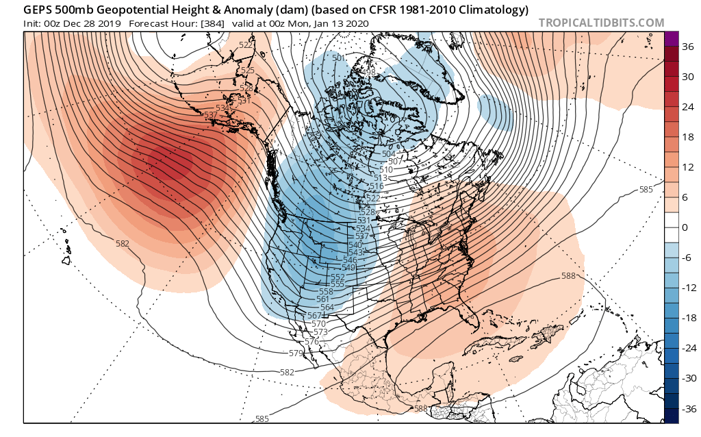
High temperatures will range from the 60s inland to even 70s at times along the coast, however many locations will experience daytime highs in the 50s and 60s. But what about beyond the 6-10 day range? Well, we are seeing what we think could be a ridge trying to build into Alaska, where the extreme cold looks like it may erode away. The GEPS or Canadian ensemble mean shows a ridge trying to poke into Alaska once again. If this is true, more cold air will be forced into Canada and could serve as a loading mechanism for the East Coast. Models tend to have a southwest bias when it comes to troughs, mainly the Euro and Canadian. Over time, they may shift the trough east once the time in question draws closer.
By January 7th or so, we are no longer seeing a pronounced ridge on the Euro for the East Coast nor above-normal temperatures. Stay with us to see how the pattern evolves!

-CWA
You must be logged in to post a comment.