
There is chatter about a potential split of the Polar Vortex, which would sent mid-winter temperatures to our region in mid December. Daytime highs would only be in the 20s and 30s, and overnight lows could be in the teens and even single digits for some.
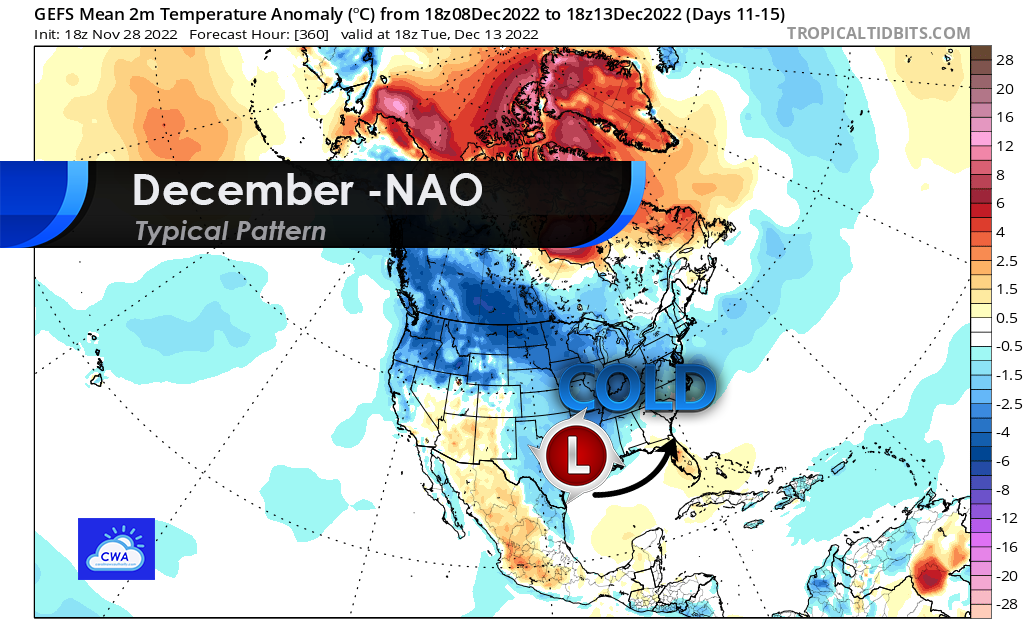
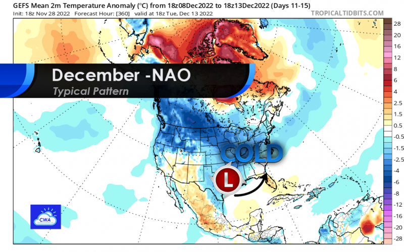
Typically a Negative NAO index and Negative AO index means blocking over Greenland, which is shown by abnormally warm temperatures in the above graphic. As a result, all over the cold air normally over Canada is forced south.
The timing for this event seems to be after the 8th and perhaps into the 15th or 16th. Winter storm tracks will be more favorable for our region. December is certainly a month to watch with the upcoming pattern change.
-CWA
You must be logged in to post a comment.