
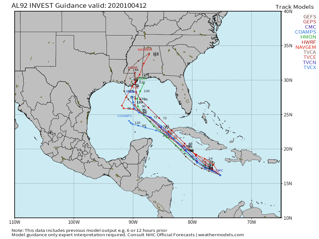
We have Invest 92L brewing in the Caribbean, and currently is given a high chance of development by the NHC over the next 5 days. As this system “shoots the gap” between Cuba and Mexico, it will remain over water where it will intensify over the next 5 days or so. It will then be over the open waters of the Gulf. How much this storm will strengthen is still unknown. Below is the latest model track guidance for what could be future Tropical Storm or Hurricane Delta. New Orleans is in the path, and of course anyone in this area should monitor this potential hurricane.
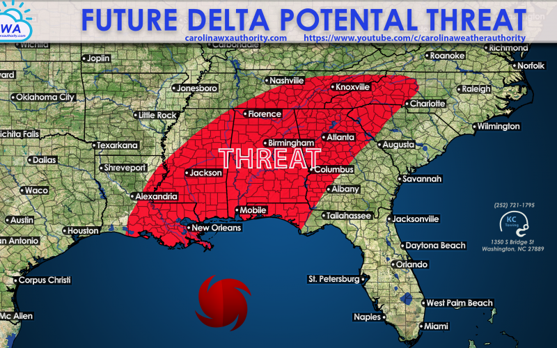
It’s not clear how powerful this storm will become, therefore if it is weak, impacts will not be felt too far inland. But if this storm blows up into a Cat 3 or 4, then impacts will be felt well inland. The storm could take a slight right turn after making landfall, thus bringing the threat for flooding, power outages, and tornadoes to the red area around 10 days from now. We are looking at October 13th or so for any inland impacts.
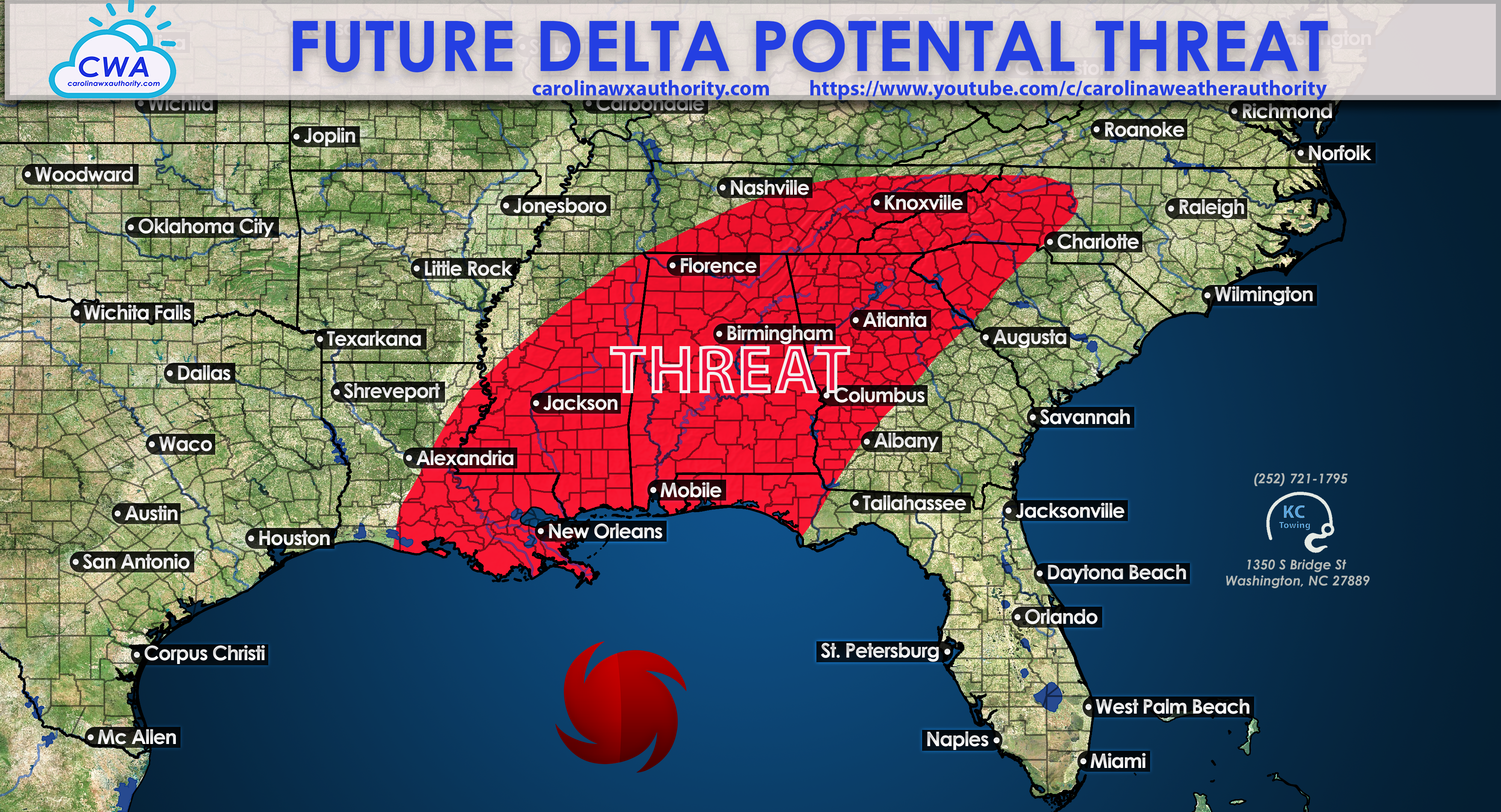
Since this is a developing situation, we will not know more details until possibly later this week. Please stay tuned to our FB page and our YouTube channel (shown in the graphic) for our latest updates!
-CWA
You must be logged in to post a comment.