
Talk has been filling social media with the potential for snow across the South. Can we validate that? We aren’t going to say the snow will be significant just yet, but what we do see is the potential for some snow to fall across northern NC and southern VA.
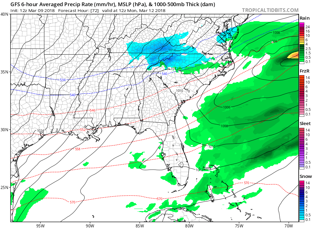
A cold rain spread across NC, SC, and VA during the day Sunday. Then, as the storm moves offshore it intensifies and snow starts cranking up across NC and SC. This will be a very suppressed system, so do not be surprised if some locations get nothing or all rain, especially the farther NORTH you go. This is a southern system.
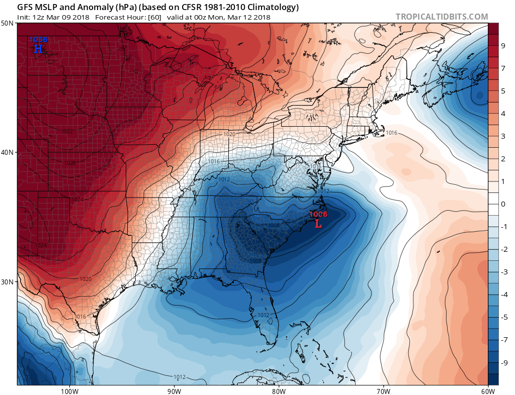
Behind the departing southern storm system, the cold will return. Many crops that have started to grow or bloom could once again be in jeopardy. Temperatures will dip below freezing in western NC and western VA.

So now begs the question, how much snow? What kind of amounts are we looking at and for who? We can’t say exactly for either question, but we can show model output from the GFS and Canadian. First is GFS, second is the CMC.

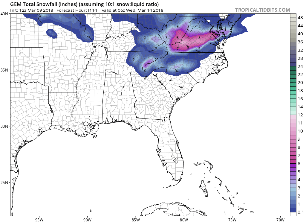
If you live in Charlotte or Virginia, and want snow, you will be rooting for the Canadian model (2nd image above).
Thanks for reading and if you enjoyed this segment, please share with your friends using the buttons below!
-Mike G.
Meteorologist
East Coast Weather Authority
You must be logged in to post a comment.