
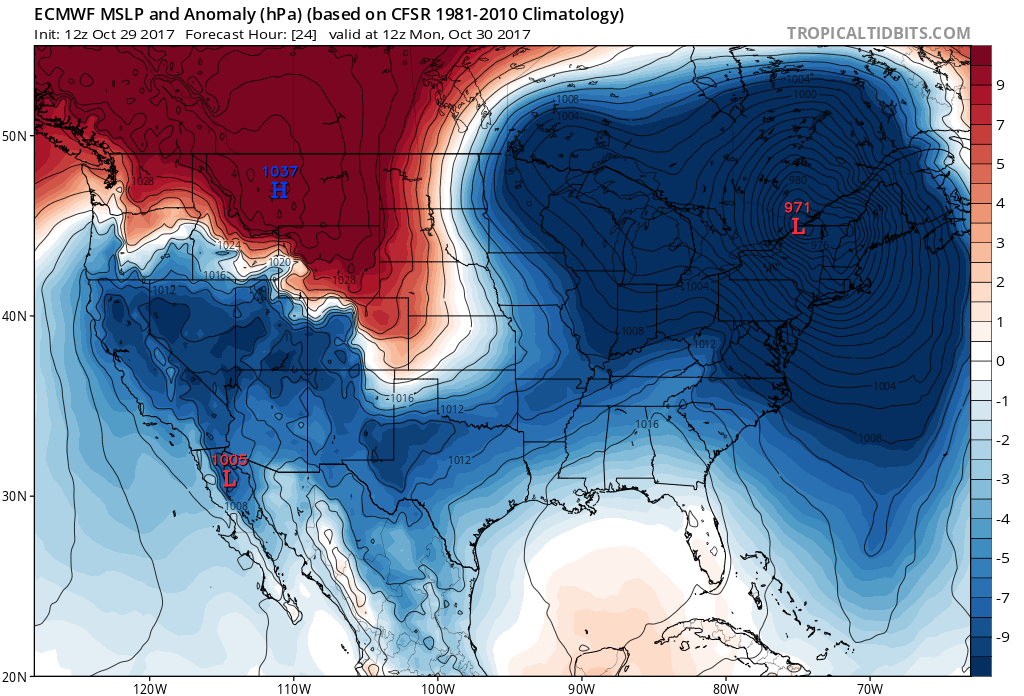
A powerful storm will crash onshore somewhere near Long Island or Coastal New England late tonight and into Monday. Residents along the coast from Southeast Virginia all the way up to Cape Cod will see raw and rainy conditions today and tonight, and also the wind will be picking up. The main impact are of this coastal low will be for New York City if the track remains west. Now, the NHC does have what is now Phillippe on a more eastward track, and hitting Maine. So there is some uncertainty where exactly the low will make landfall.
Euro has it over upstate New York by 8am Monday morning, so this low will be trucking and will not stall or linger.
What can we expect for the weather locally?
SOUTHEAST US, INCLUDING NC, VA, SC
TONIGHT: We can expect temperatures to remain in the 60s near the coast, for both NC and VA, as the front is not completely through that area just yet. Rain will be heavy at times, and winds will gust from 20-30 mph. As the storm system moves away, we can expect clearing and colder conditions. Coastal NC the rain stops sometime later today completely, but for SE VA the rain will continue into tonight but will taper off. It will become windy, as temperatures will drop.
Charlotte and for the rest of the Carolinas, breezy today, and temperatures dropping like a rock tonight. We will be waking up to temperatures in the 30s Monday morning. Make sure you set your coat aside tonight, because you will need it in the morning. Sunny and breezy for Monday, and cold. The cold likely continues into Halloween, so you may need a coat for the trick-or-treaters.
NORTHEAST US, INCLUDING PHILADELPHIA, NYC
Rain will continue today and tonight, heavy at times, and also the winds will be picking up. We can expect power outages since the winds will likely take down trees and power lines. Winds could gust to 50 mph or even higher. This storm continues into tonight and into rush hour Monday. Plan to leave plenty of extra time for the morning commute, as it could be very messy. Rain then finally moves out by mid-morning, and much colder air will be blowing in from the northwest. You may want to secure any loose outdoor items. Temperatures will be chilly tonight, with lows in the 40s.
Looks like a chilly Halloween for the Northeast as well. Temperatures Tuesday morning will dip down into the upper 30s. This chilly air will remain through Halloween.
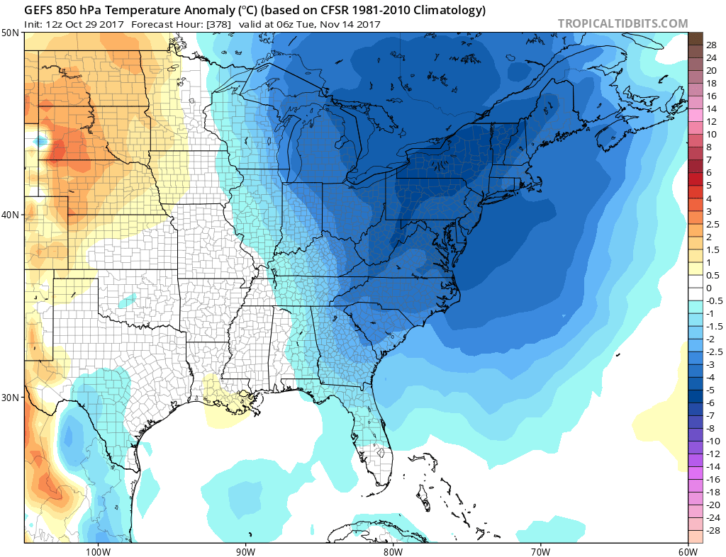
However, we will creep back up to above normal temperatures into the first week of November, as models have flipped. They are now showing much warmer than before. This will be the trend from the 5th into the 6th. BUT, it does NOT last, as there will be some sort of cold shot or coastal low around mid-November. So, do NOT let the upcoming warming trend fool you.
Warming trend into the 6th –

Something possibly happening around the 12-14th –
You must be logged in to post a comment.