
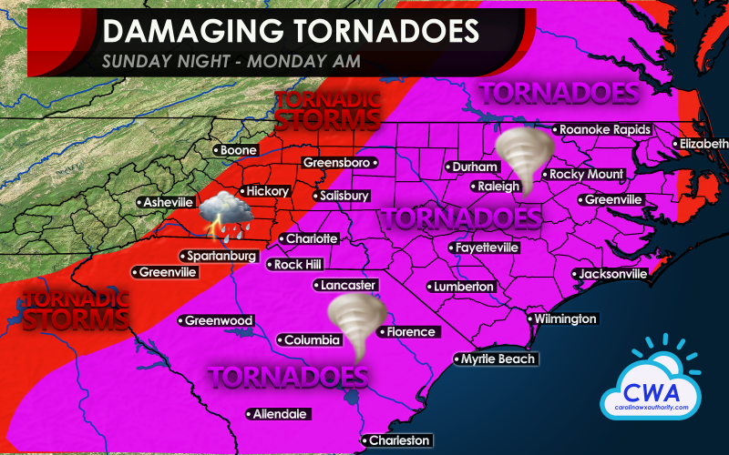
There is still a higher than normal threat for severe weather for the Carolinas Sunday evening and night and also into Monday morning. Storms will spread across the forecast area this evening, and some of these could be strong to severe and could put down tornadoes. This threat increases into the nighttime hours tonight, and will remain high throughout the night. Monday morning is when the cold front pushes through, and the threat for tornadoes will be high once again. The highest threat for tornadoes is tonight but especially Monday morning east of Charlotte all the way to the coast. This threat extends from GA up into VA and east.
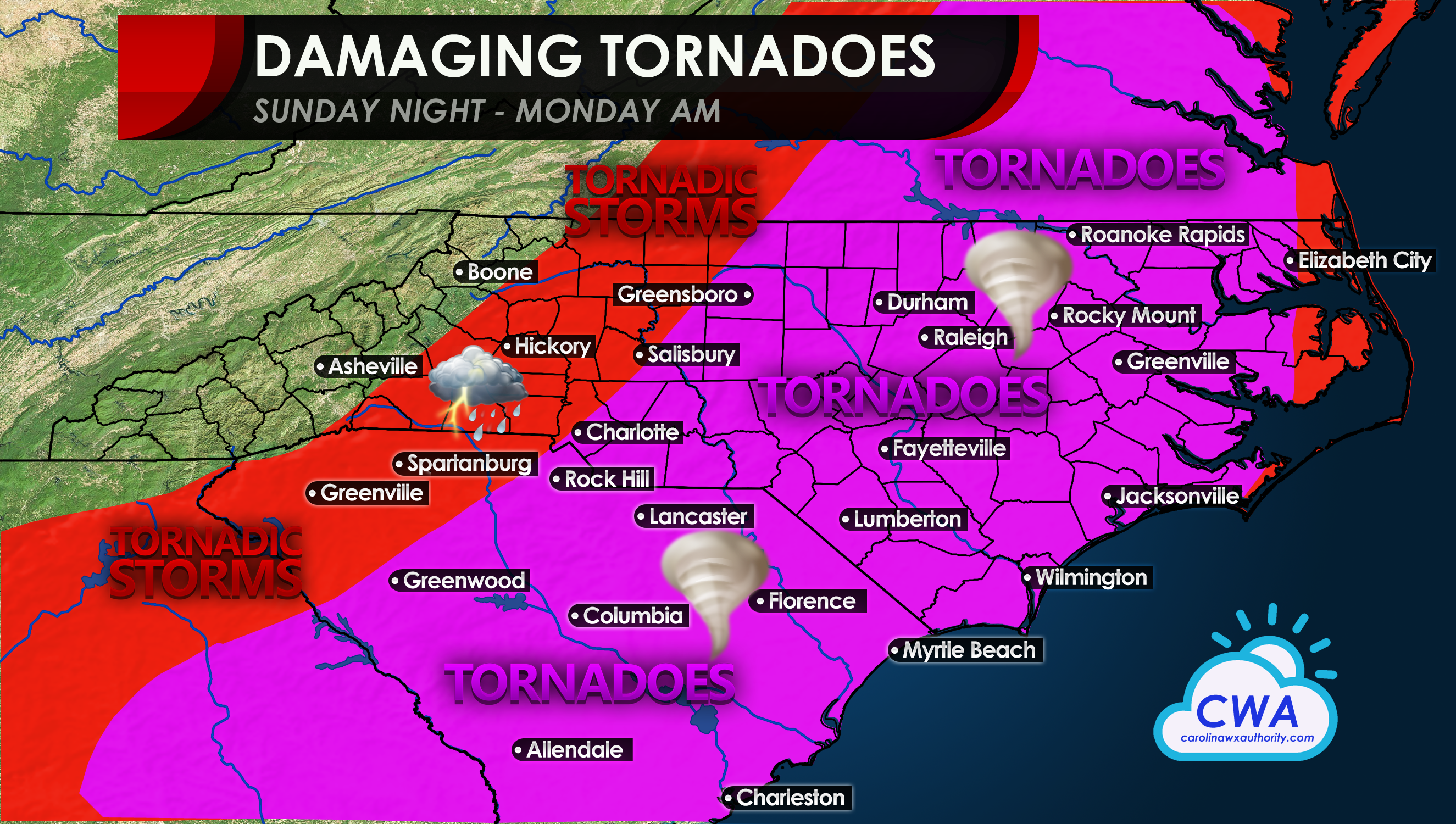
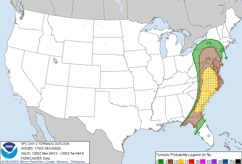
The SPC has the highest chance of tornadoes in this area for Monday, however the threat will extend a bit farther west if we consider Sunday night also and not just Monday.
This is an extremely dangerous situation should this forecast verify. Night time tornadoes are especially dangerous since many people will be asleep and they will not be able to see a tornado approaching. If a loud freight train noise is heard, or if your local NWS issues a tornado warning, head to your designated safe space and follow all NWS instructions.
The timing is this evening into tonight, and also Monday morning.
Consult your local NWS for all official warning informations.
You must be logged in to post a comment.