
SALLY IMPACTS
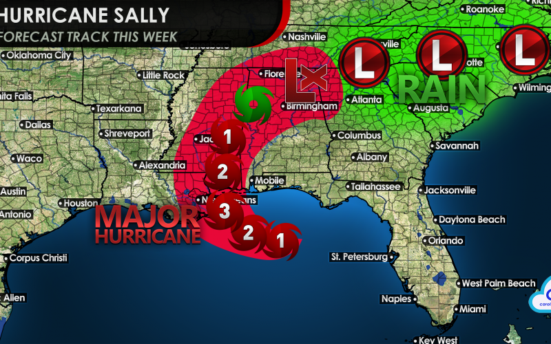
As Sally is getting ramped up as a hurricane, she will continue to intensify tonight as she slowly approaches the Gulf Coast. She has already undergone intensification, and a rapid drop in pressure. This could be a hurricane that strengthens rapidly over a relatively short amount of distance. When the Gulf is warm and conditions are right, major hurricanes can make landfall on short notice.
She could be a Category 3 by the time she starts moving over southeastern parts of Louisiana. New Orleans will also feel impacts from this storm, but will be borderline in severity.
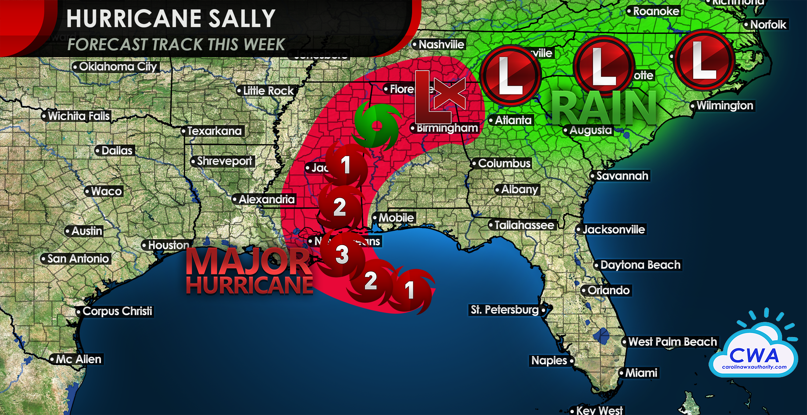
As Sally makes her way inland into Mississippi and Alabama, widespread power outages and flooding are likely. This storm will be moving slow so it may dump a ton of rain, and may weaken faster than we think. But then a right turn is likely thereafter.
As of now, it looks like Sally will be a remnant low as she moves over the Carolinas, and will possibly bring a good bit of rain. Heavy rain and flash flooding are the concerns here in the Carolinas around Thursday this week. While it is not guaranteed the remnants will move directly over us, there will still be a lot of rain.

There could be some winds also but right now we are not thinking any more than 25 mph when she moves over our area. The remnants will get swept away by a cold front and we will have a beautiful much nicer weekend along with fall-like temperatures!
Stay tuned right here at Carolina Weather Authority as our meteorologists will bring you all the latest.
You must be logged in to post a comment.