
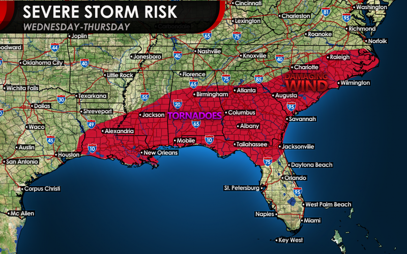
With the wild winter warm weather comes, you guessed it, the threat for severe storms including tornadoes. The epicenter of the action could once again be across Dixie Alley, where they have already seen enough action so far this season. This will be ahead of a strong cold front as it pushes east late Wednesday into Thursday. The main risks associated with the Carolinas will be damaging winds east of I-85, however the isolated tornado cannot be ruled out in any given location.
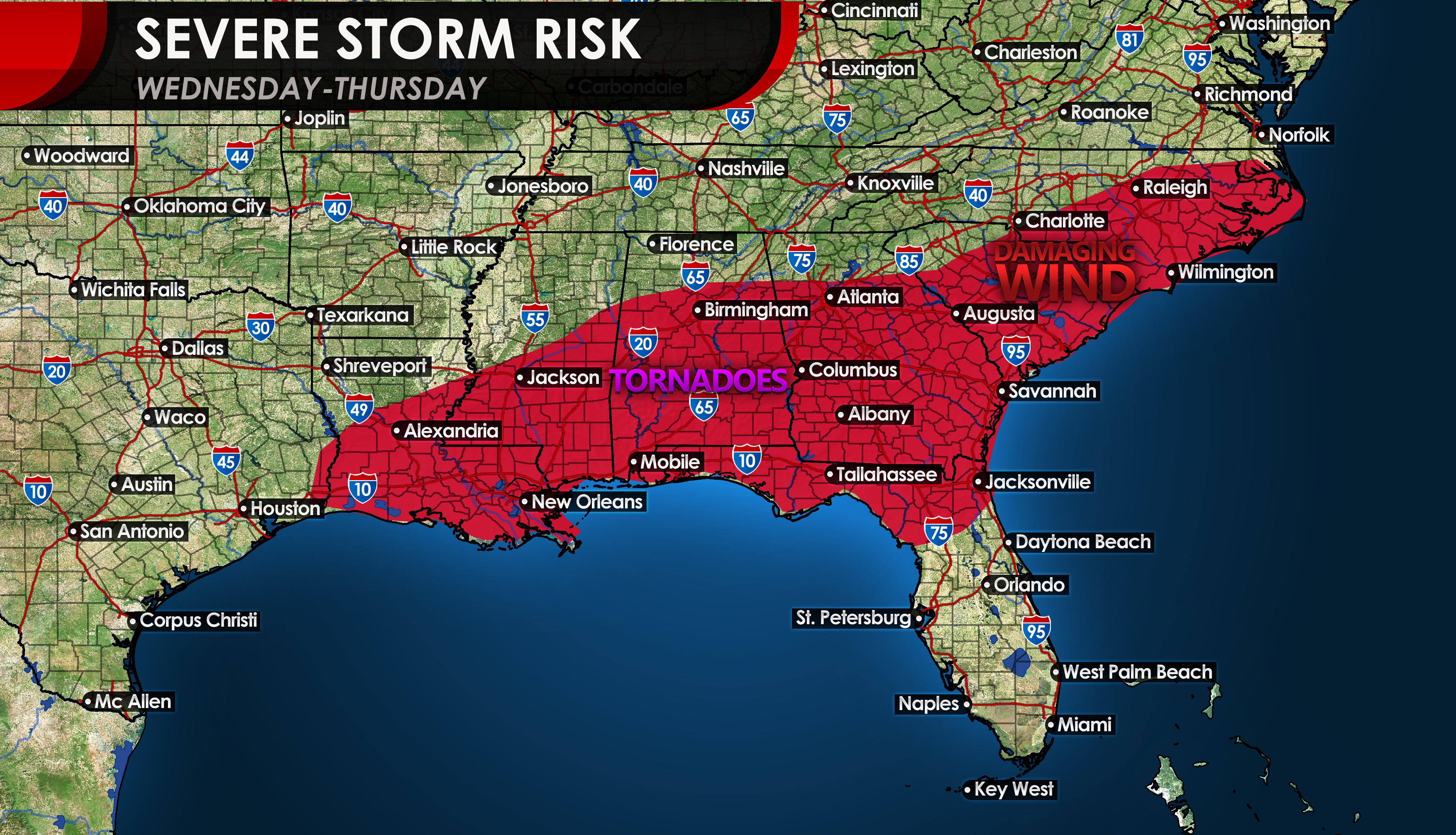
Besides damaging winds and the isolated tornado, the other main threat will be flooding rains for the western Carolinas. The GFS has a large swath of heavier rain overnight Wednesday into Thursday, which could cause flash flooding. However the main concern with this storm system is the severe potential ahead of it, which would be Wednesday afternoon into Wednesday night.
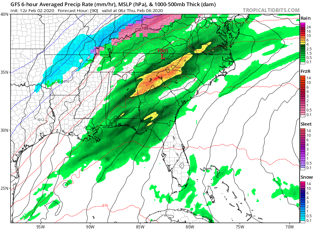
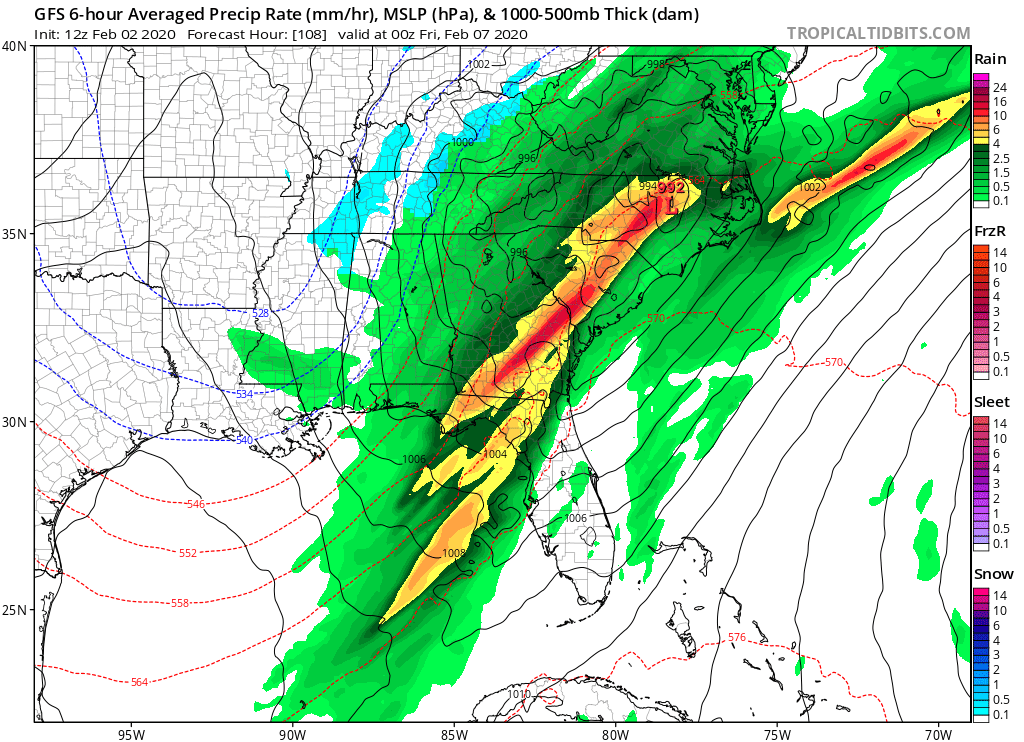
This storm really starts to crank up on Thursday and into Thursday night (below), bringing heavy rains to eastern parts of the Southeast, including the coast. By the weekend, we will clear out once again and will turn colder.
It will be well-above average in terms of temperatures this week, so get outside and enjoy it while you can, especially for physical activity. I know I will be. But pay attention on Wednesday for threatening storms.
-CWA
You must be logged in to post a comment.