
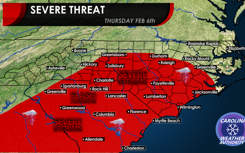
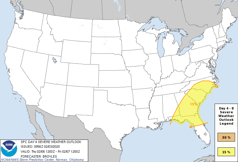
The SPC, or Storm Prediction Center by NOAA has included much of North and South Carolina in a severe outlook for Thursday. This is unusual this far in advance as we are still 4 whole days out. What does this mean? It means that this has our attention, as it could be a fairly significant event.
A multi-day severe outbreak could get started across the Deep South on Wednesday, including damaging winds and tornadoes. This threat pushes east into our area on Thursday. If the sun is able to come out during the day, this could mean a severe weather day for us. The threat for damaging winds is there, but there is also a threat for tornadoes.
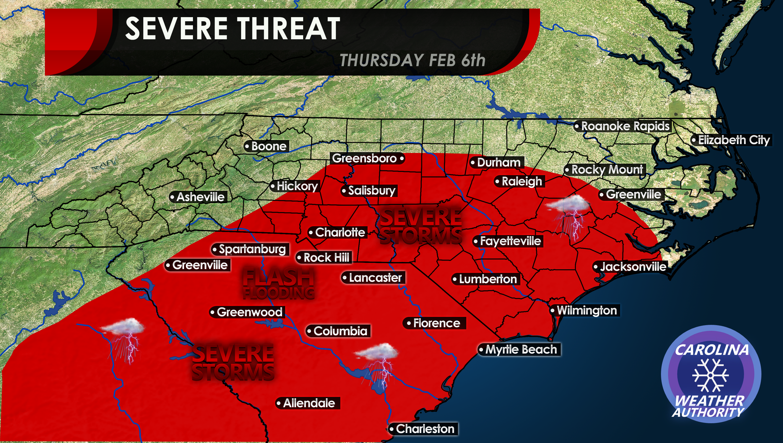
The SPC is indicating a well-in-advance severe threat for Thursday. This is rare 4 days in advance. Residents across the Southeast U.S. should think of a safety plan in case severe weather strikes.
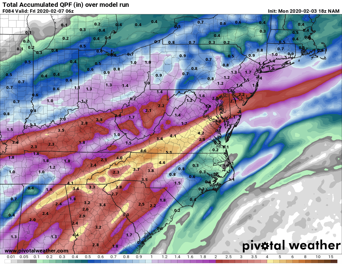
Another threat is flash flooding, as extremely heavy rains are also expected. IF the severe weather does not pan out, then we can expect flooding downpours, especially in the western Carolinas. Shown are rain totals into Thursday night.
We will continue to update on this developing storm, so stay with us!
-CWA
You must be logged in to post a comment.