
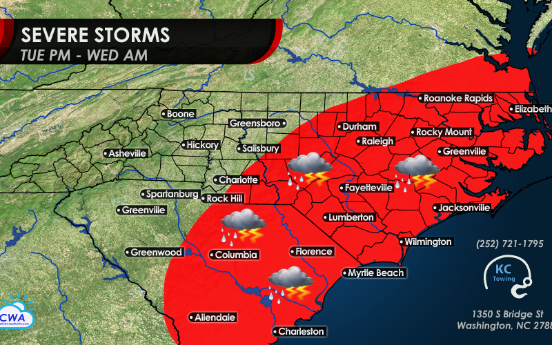
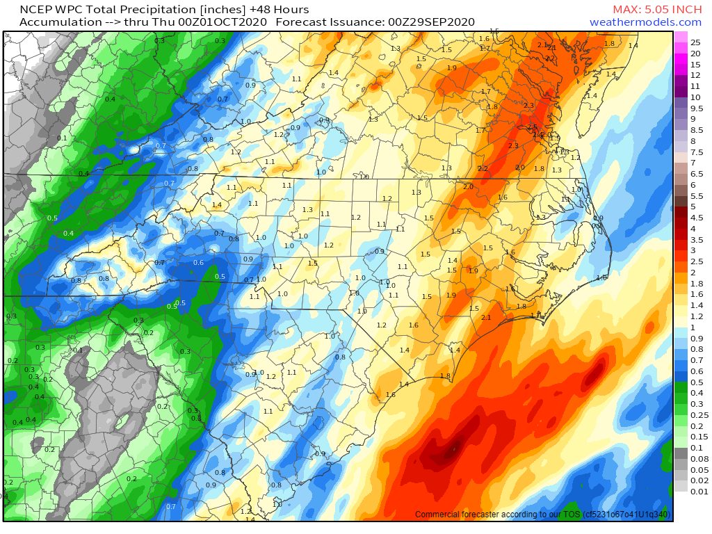
A strong cold front will move into the region later Tuesday, bringing lots of moisture along and ahead of it, leading to locally heavy rain in the afternoon west of I-85 and during the evening and late night hours east of I-85. Rainfall totals look to generally range from 1-2 inches, with higher amounts possible across the eastern part of the region late Tuesday night. Amounts have been lowered some as the timing of the storm system has sped up, and looks to be leaving the coastal region early Wednesday. However, localized flooding is still possible, especially where thunderstorms enhance rain rates.
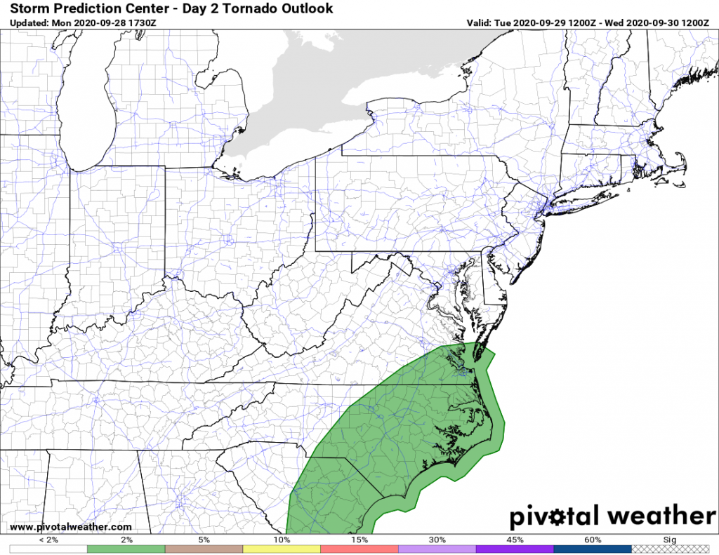
Severe thunderstorms are still possible for some, but widespread severe weather will not be as likely as we can sometimes see this time of year with powerful cold fronts. The reason is that cloud cover and some showers in the eastern part of the state may keep the air from getting too unstable during the afternoon. However, powerful winds aloft could still present the risk for scattered power outages, tree limb damage, and an isolated tornado late Tuesday afternoon west of the Triangle, Sand Hills, and Midlands, during the early evening for the Triangle and Midlands, late Tuesday evening near and just east of the I-95 corridor, and late Tuesday night for the Low Country and coast. Hail does not look likely at all unlike some in the Triangle saw Friday evening.
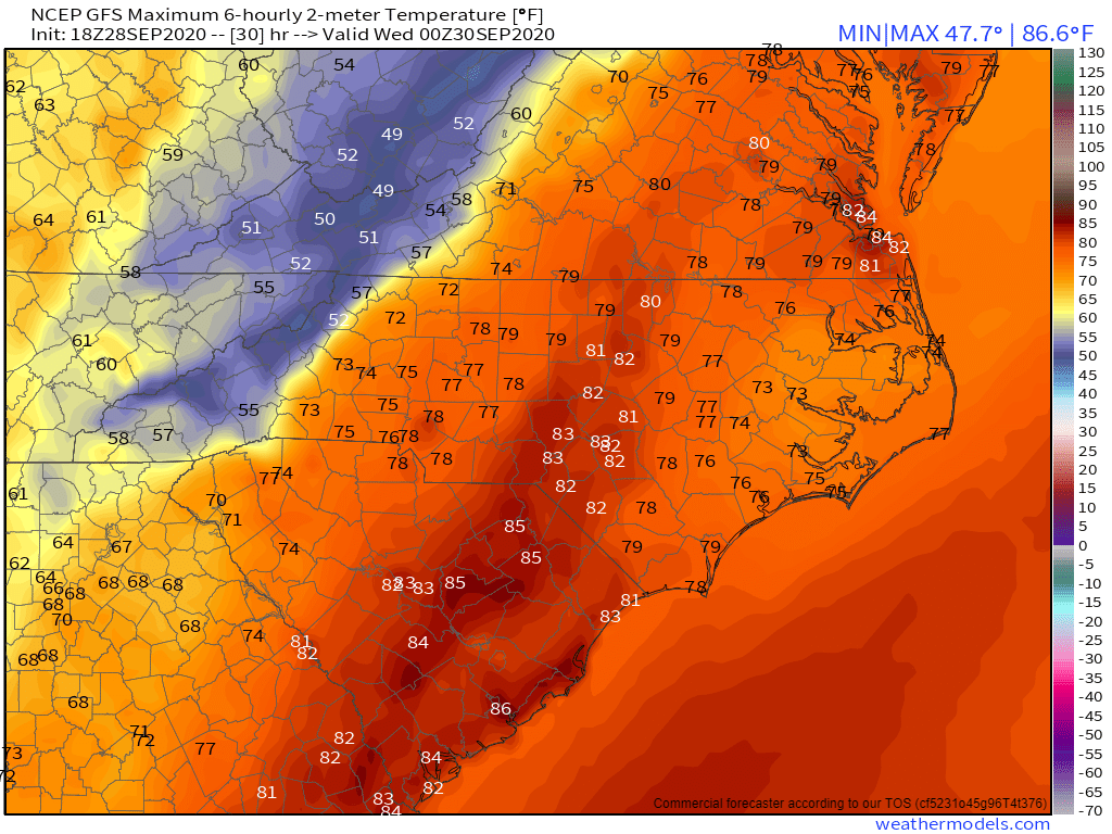
Humid conditions will remain in place Tuesday, with forecast highs in the mid to upper 70s west of the Triangle and Midlands, and lower to middle 80s east of I-85. Clouds and occasional rain could hold temperatures down some in eastern N.C. But notice that much colder air will be flooding western North Carolina late in the day as the front pushes through.
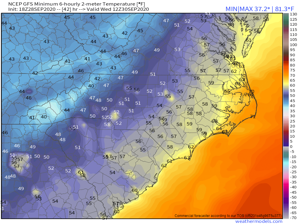
Tuesday night will turn colder behind the front, with lows in the upper 30s and 40s in the High Country, 50s across most of the region, and 60s at the coast. This cooling trend has sped up by 6-12 hours from earlier weekend forecasts.
Wednesday through Friday will end up on the cool side, but probably no colder than the early part of last week. Most of the area will have highs in the 60s to low 70s, with lows in the 40s to low 50s. Mountain areas will be chilly and possibly frosty later this week, benefitting the vibrance of this autumn’s foliage season as we head into October.
The tropics will be worth watching after this week – with a 50 percent chance for development in the western Caribbean by Saturday. Watch our latest video on YouTube which goes more into the chances of not one, but possibly two tropical threats to the Southern U.S. during the first half of October.
-CWA
You must be logged in to post a comment.