
As a powerful cold front will push in from the west, it will bring the threat of storms with damaging winds and a squall line. Of course tornadoes can be associated with these lines. Tuesday is already on the SPC’s radar in advance, therefore we can conclude with confidence to watch also.
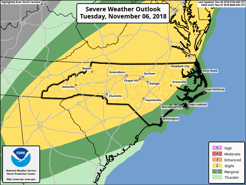
Much of NC, SC, and GA are under the gun for a round of severe storms. But who is most likely to see damaging storms?
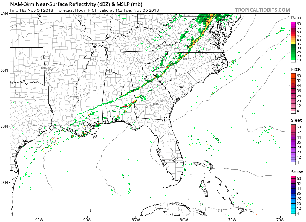
At the present moment, the NAM model is indicating a thin line of storms. In order for a severe event to unfold in the Charlotte area, the storms have to make it across the mountains. In our futurecast image below, there is a thin line of storms, but in reality we will have to see if the storms hold.
Stay weather aware Tuesday and we will bring you the latest updates! Consult your local NWS office for the latest.
-ECWA
You must be logged in to post a comment.