
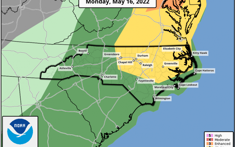
Severe storms are possible across much of eastern and northern NC Monday, which could bring damaging winds and hail. The tornado threat is low but not zero.
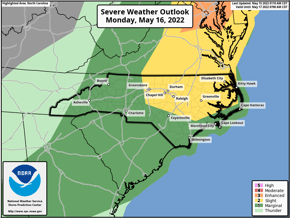
According to NOAA SPC, the threat for severe storms will increase with daytime heating, as the hot air will provide fuel for storms.
Latest from the SPC:
 As the seasonably moist pre-frontal boundary layer heats through the
   afternoon, destabilization will fuel development of scattered to
   numerous thunderstorms.  Given the aforementioned strong flow aloft,
   storms will quickly organize, some growing into fast-moving
   clusters.  Along with risk for hail, damaging winds should be become
   increasingly widespread through the afternoon.

   Additionally, low-level southerly/south-southeasterly flow is
   forecast, particularly from portions of Virginia northward into New
   York.  Resulting enhancement to the low-level shear suggests
   potential for a couple of tornadoes, as well.

   Storms/severe risk will continue through the afternoon and into the
   evening, until the front nears/clears the coast.  Risk will diminish
   with southward extent from the Carolinas southward, where flow aloft
   will be a bit weaker.  Still, locally strong wind gusts may occur as
   far south as Georgia during peak afternoon convective intensity.
If you live in the yellow in NC or VA, monitor the weather tomorrow for warnings and any safety actions if needed. Consult your local NWS office for all official weather-related decision making.
You must be logged in to post a comment.