
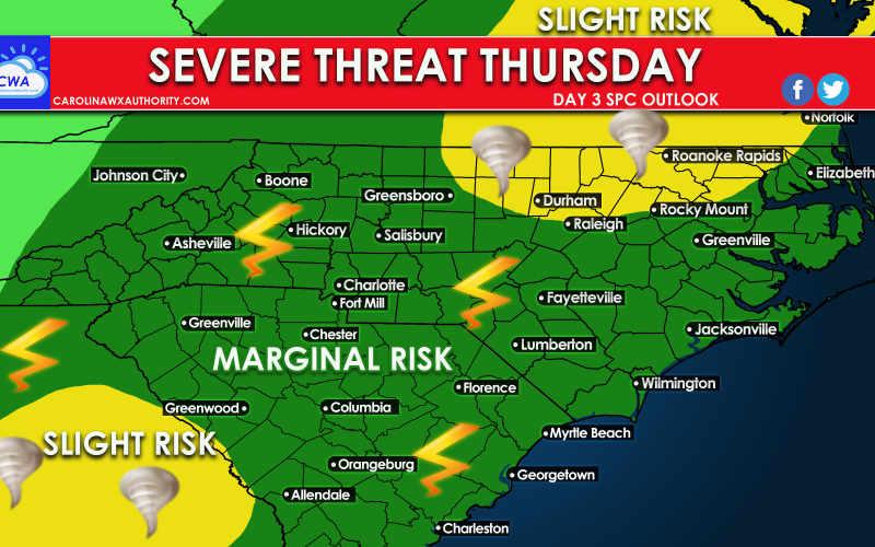
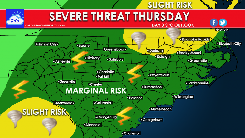
Latest trends indicate we are still expecting some kind of severe weather event on Thursday. Currently the exact modes of severe are still unknown, however damaging winds and tornadoes are still on the table. There is a large area of a marginal risk out for the Carolinas, and two distinct spots for a slight risk.
As severe storms including tornadoes kick off across the Deep South on Wednesday, we will need to monitor their progress into our area on Thursday. A powerful cold front will be the culprit for severe storms.
Official forecast discussion from the SPC regarding Thursday:
...Mid-Atlantic...
   Two opportunities exist for thunderstorm development across the
   Mid-Atlantic region on Thursday. The first is early in the period as
   a shortwave trough moves quickly northeastward from the Upper OH
   Valley through the Northeast. Buoyancy will likely be limited ahead
   of this wave, but strong forcing for ascent and robust wind fields
   could still support isolated thunderstorms capable of damaging gusts
   across PA and NJ.

   The second opportunity will be along the front expected to move
   southeastward through the region during the evening and overnight.
   As with the earlier storms, buoyancy will be modest, tempered by the
   lack of colder temperatures aloft and resulting steep mid-level
   lapse rates. Even so, forcing along the front, which will be
   augmented by ascent attendant to another shortwave trough moving
   through region, should result in thunderstorm development. Most
   likely location for this development is from central VA northward
   into the Delmarva. Robust wind fields over the region will result in
   the potential for organized thunderstorms capable of damaging gusts.
Link to the SPC: https://www.spc.noaa.gov/products/outlook/day3otlk.html
As always, consult your local NWS office for all safety recommendations and decision-making, including official information to protect life and property.
You must be logged in to post a comment.