
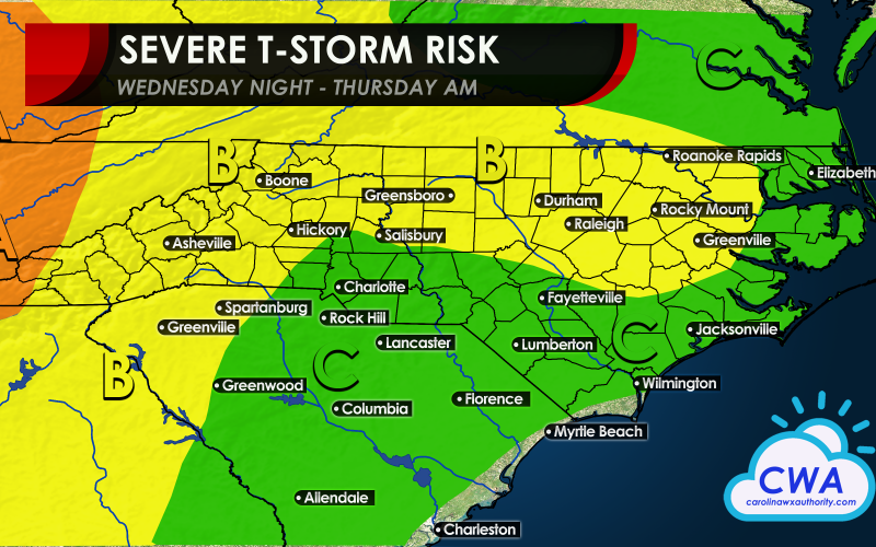
There is a Slight Risk for much of NC and into the Upstate of SC tonight and into the early morning hours of Thursday. Future radar indicates there will be a preliminary cluster of storms that forms in eastern NC around 10 pm tonight, but that will not be the main troublesome line that moves in. There still could be some isolated storms that contain small hail in this cluster, however.
Future radar for around 10 pm tonight:

But the more dangerous line will be tonight out ahead of a strong cold front. This line looks to push through Virginia and the Carolinas between midnight and sunrise Thursday. Since this will be a nighttime situation, it is advisable to have a source for warnings tonight even while you sleep.
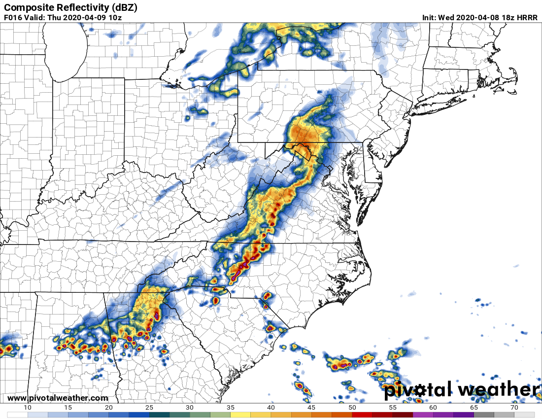
Future radar for 6 am Thursday showing much more extensive coverage of thunderstorms:
See the map legend below for what you can expect tonight in your neighborhood:
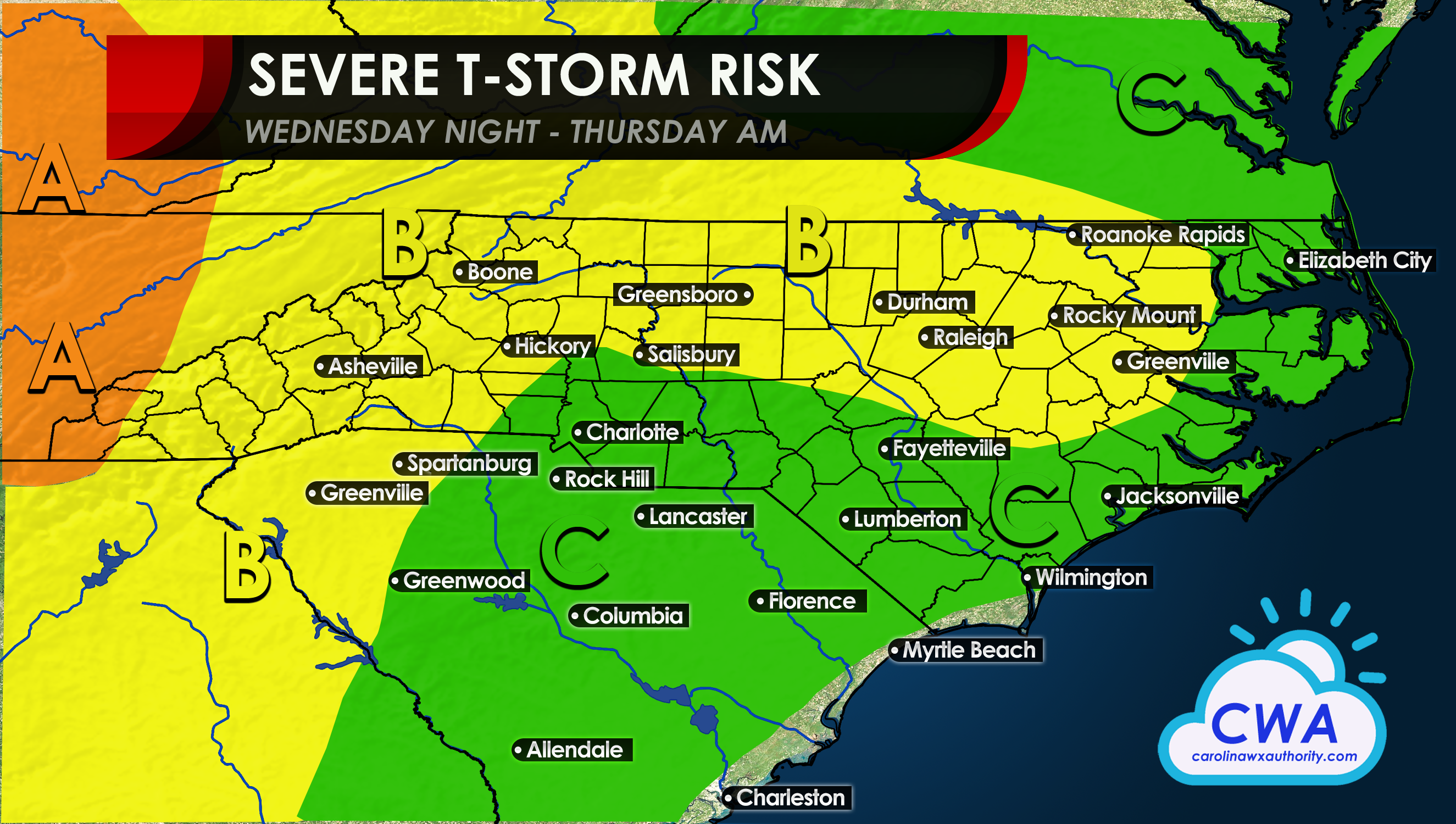
Area A: This is the most likely area for severe storms including high winds, hail, and tornadoes. This is one of the more dangerous areas to be in.
Area B: The main threat will be for damaging winds and hail, but an isolated tornado cannot be ruled out. This area also needs to remain weather-aware tonight.
Area C: There is an outside chance for severe storms in this area, nothing can be ruled out such as damaging winds, hail, and an isolated tornado. However the chances are lower than the above two.
Again, have a source for warnings from the NWS before you go to bed, and heed all warnings!
-CWA
You must be logged in to post a comment.