
Severe weather is possible again Saturday as a series of MCS (Mesoscale Convective Systems) begin diving southeast. These type of complexes typically originate in the Midwest or Ohio Valley and dive southeast this time of year with their main punch generally being damaging winds. We alluded to the potential that this might pattern might eventually occur in an article about a week ago and indeed it seems to be transpiring. This is not exactly the same setup as we saw Thursday. A number of complexes will dive in from the northwest between early Saturday morning and Saturday night. Timing and exact track can be difficult to determine with these because of their fickle nature in development.
According to our current forecast data, our first MCS may dive south by very early tomorrow morning. However, after traveling all the way from the Upper Midwest, we may see this one weakening considerably as it reaches our area. It may be still be strong, and some gusty winds and heavy rain cannot be ruled out. Yet another may arrive in the early morning into the afternoon with what will likely be our best chance of severe weather for the period. Damaging wind gusts are likely with a slight risk for hail and a low risk of tornadoes, especially over South Carolina. Torrential rainfall and frequent lightning are also be expected. A question mark revolves around the idea of a potential third complex affecting parts of the region in the evening into Saturday night with more severe weather. Check back for updates.
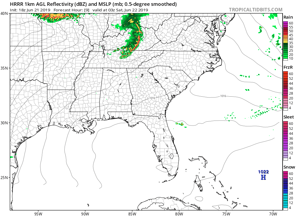
Check out the 18z Hrrr model projected radar loop of the multiple complexes diving in from early tomorrow morning through tomorrow night. This isn’t an exact representation of what is going to occur, but just a general idea to illustrate how active it will be tomorrow.
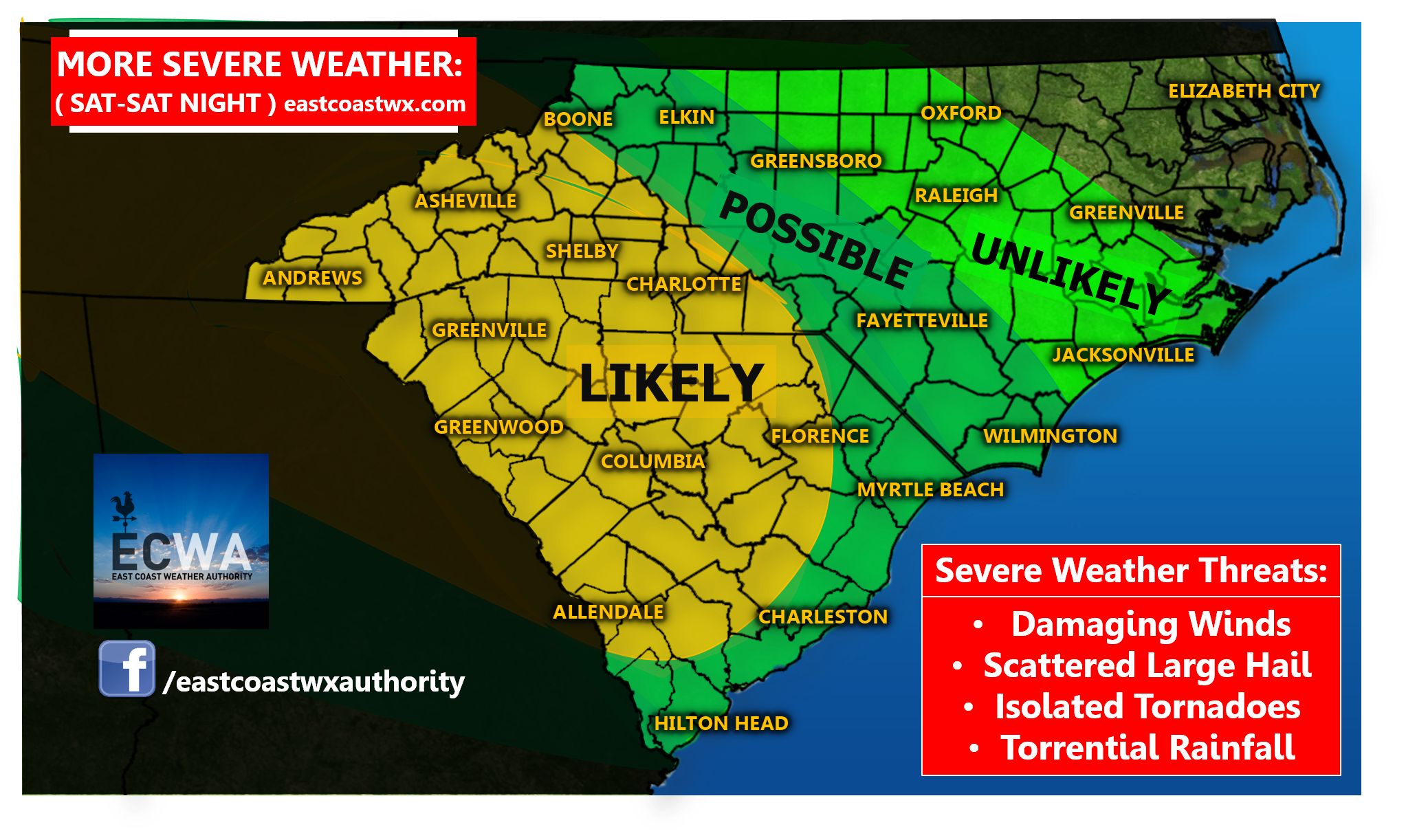
Here’s a look at weather potential and coverage by zone:
Likely zone: This zone will likely see numerous showers and thunderstorms with a good chance of severe weather.
Possible zone: This zone will see some scattered showers and storms with a few possible becoming strong to severe.
Unlikely zone: This zone will likely see isolated shower or storm activity and the risk of any severe weather is fairly low.
The northwest corner of North Carolina is unlikely to see notable storm activity with zero chance of severe weather.
Make sure to check back for updates throughout the day tomorrow as development, timing, and track of these complexes will likely change to some extent. Stay up to date with all the latest on our Facebook page and make sure to download our free weather app available on all Android platforms and hopefully soon for all IOS users: https://carolinawxauthority.com/mobile-app/
-Jesse
East Coast Weather Authority
You must be logged in to post a comment.