
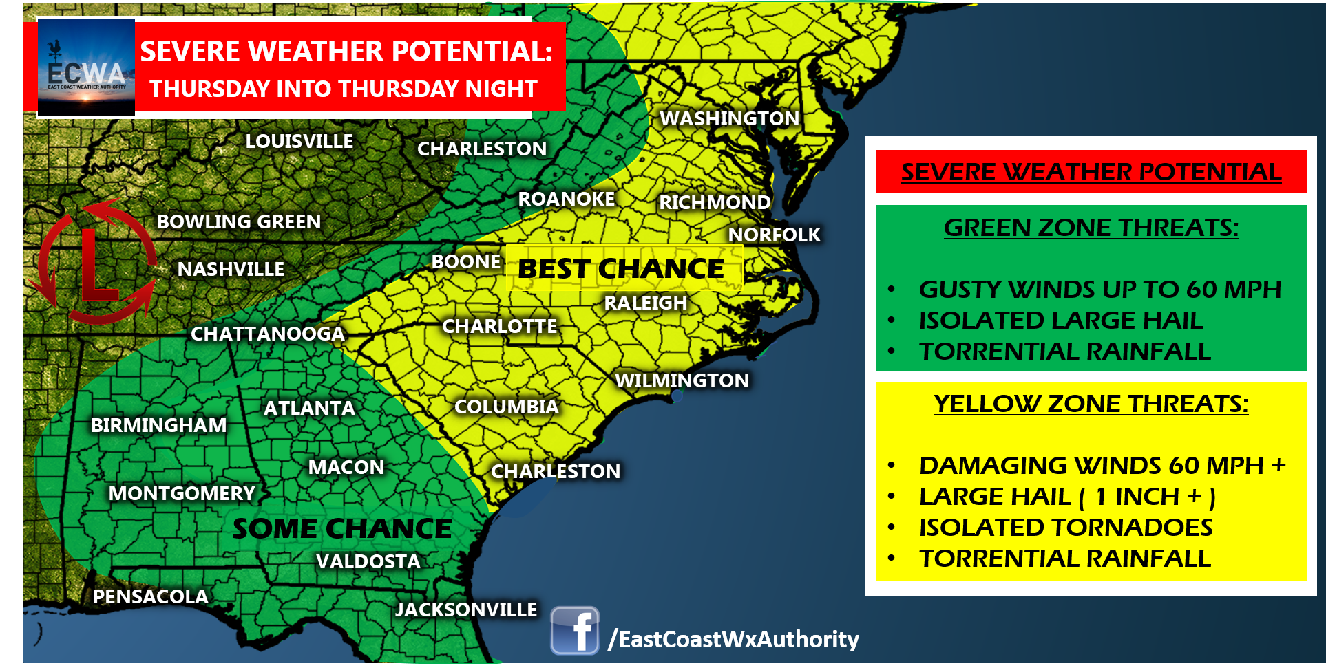
As a front makes it’s way eastward across the Appalachians to the East Coast, we likely see lines of storms develop over the Carolinas and Mid-Atlantic where the the highest risk of severe weather will exist. Areas further to the south and west may see their best chance of severe weather from a decaying mesoscale convective system diving in from the Mid-South early Thursday, but this shouldn’t carry more than a small chance of severe weather and the brunt of this will likely not reach the Carolinas or Mid-Atlantic which is why the best chance of severe weather will likely come with the passage of the cold front Thursday afternoon and evening in that area.
The coverage of thunderstorms should be on more of a scattered basis versus widespread activity according to our latest computer model consensus, but the cells that do develop could be rather robust. The primary threats across the Carolinas, and Mid-Atlantic will be damaging winds and large hail, but a small risk for tornadoes is also present if any discrete, super-cellular structures should develop.
Make sure to have a way to receive any watches and warnings and stay with East Coast Weather Authority for the latest significant weather information and updates. Also, make sure to download our app. Currently, the app is available for FREE for the Android platform, with availability on the Apple App Store coming soon!
-Jesse
East Coast Weather Authority