
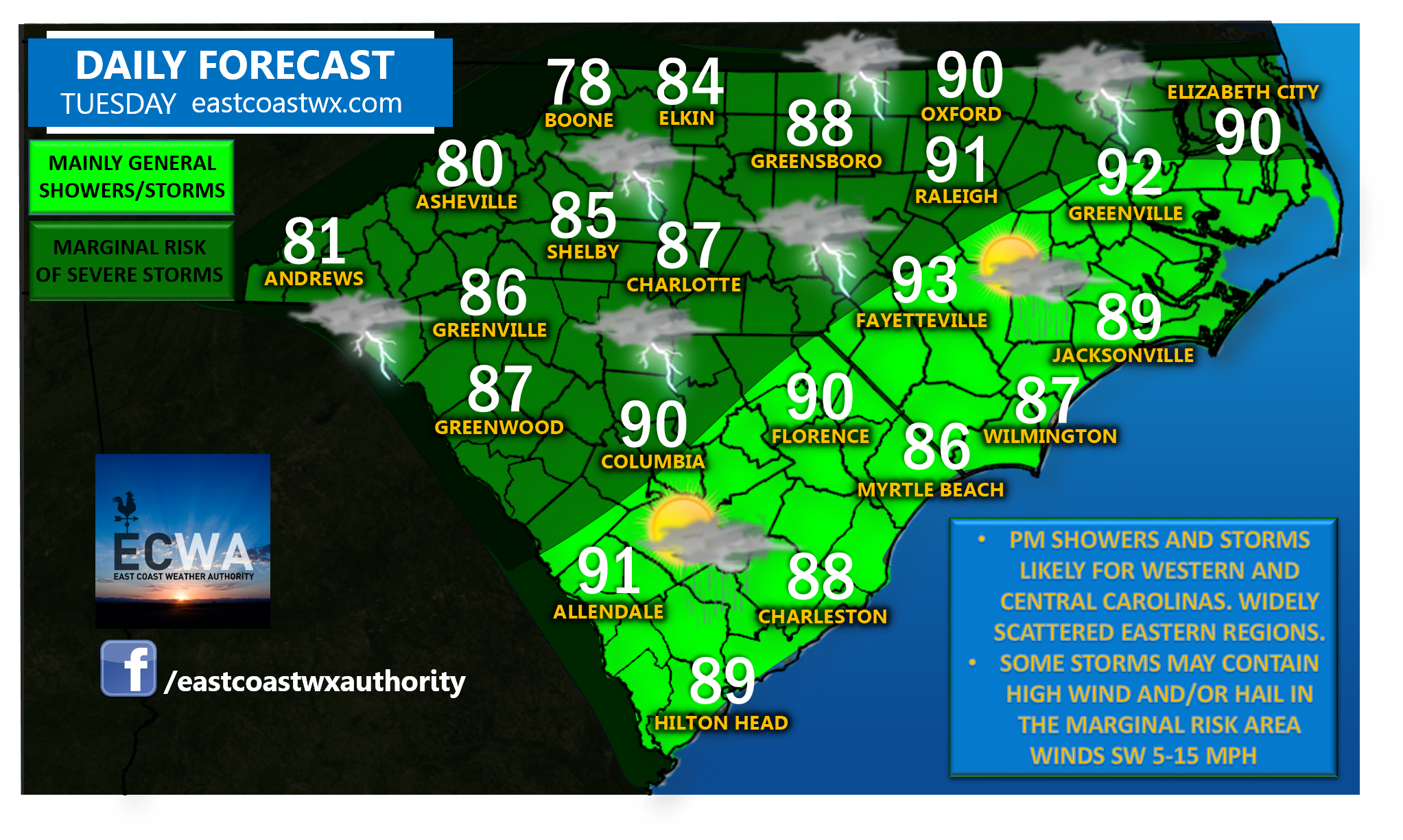
Showers and thunderstorms increase once again this afternoon and evening with the most coverage in Western and Central North Carolina, and Upstate South Carolina.
The Storm Prediction Center has placed the aforementioned regions in a “marginal” risk area for a few storms that may reach strong to severe levels and produce high wind gusts and/or hail. Dangerous lightning and torrential rainfall may also accompany some storms and any cell with heavier rainfall rates could lead to localized flash flooding, especially if training of multiple storms occurs over the same area.
Showers and thunderstorms will be more isolated to widely scattered over the Eastern Carolinas and most of those should stay below severe limits. Due to more sunshine and less coverage of activity in this area, afternoon high temperatures will skew on the higher side.
Have a great Tuesday.
-Jesse
East Coast Weather Authority