
It is that time of year again, the battle between the seasons with warm surface temperatures and cold air aloft creating the threat for severe weather to impact the Carolinas this weekend. Temperatures are to climb to near 80 degrees this weekend, but late on Sunday a strong cold front will push on through. The contrast of temperatures and strong winds aloft will create a risk for severe weather, including the possibility of a tornado or two.
Late Sunday night we will have a strong cold front push on through the Carolina region, and out ahead of the cold front warm air will be pumped into the same region creating a dynamic environment and increasing the threat for severe storms.
GFS MSLP & P-Type for 6z MON April 16th, 2018:
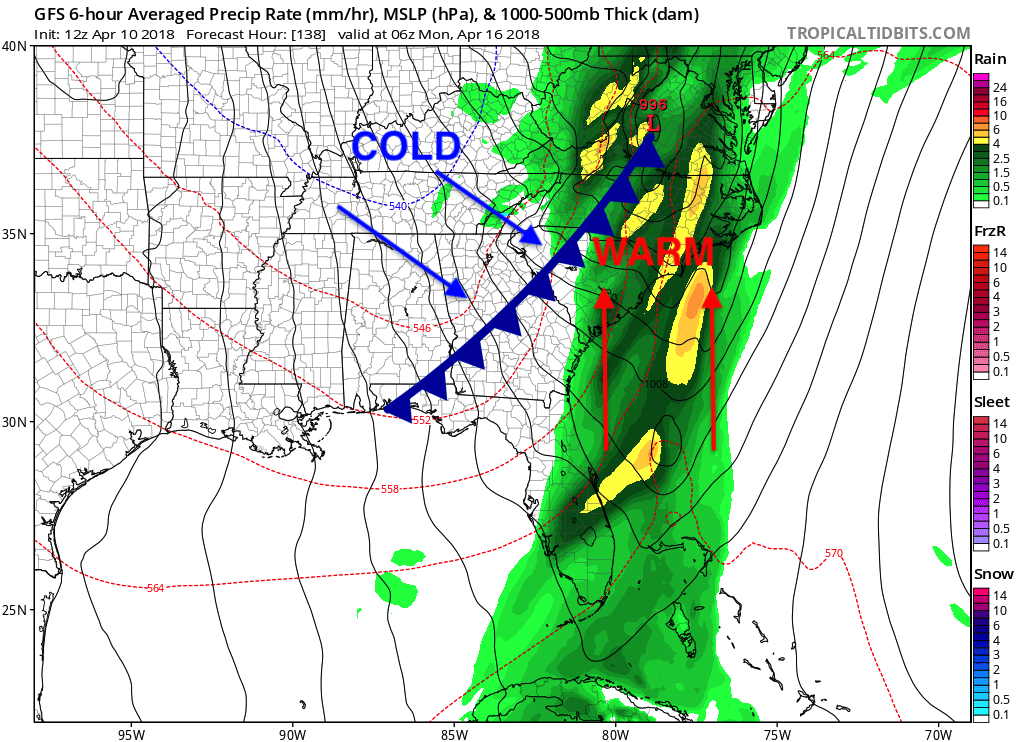
With the southern flow of warm air and the northwesterly flow of cold air will create a high shear environment which could cause some storms to rotate. Also, there will be energy available for convective storms to spawn and grow.
GFS CAPE/CIN for 21z SUN April 15th, 2018:
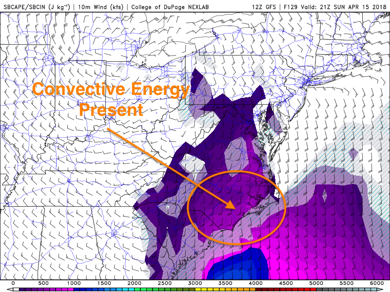
Late on Sunday, convective energy will be present allowing the threat for severe weather to spark in Eastern North Carolina and Northeast South Carolina.
ECWA Severe Forecast for SUN April 15th, 2018
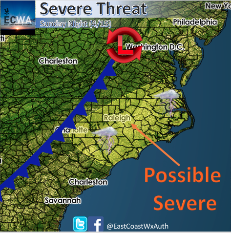
Above is our forecast to where we believe severe weather has the highest probability of severe storms to occur Sunday night. Expect some gusty winds and small hail, and we can not rule out a rotating thunderstorm. Stay here with us at East Coast Weather Authority as we keep you up to date and what to expect from mother nature.
-Alex B
You must be logged in to post a comment.