

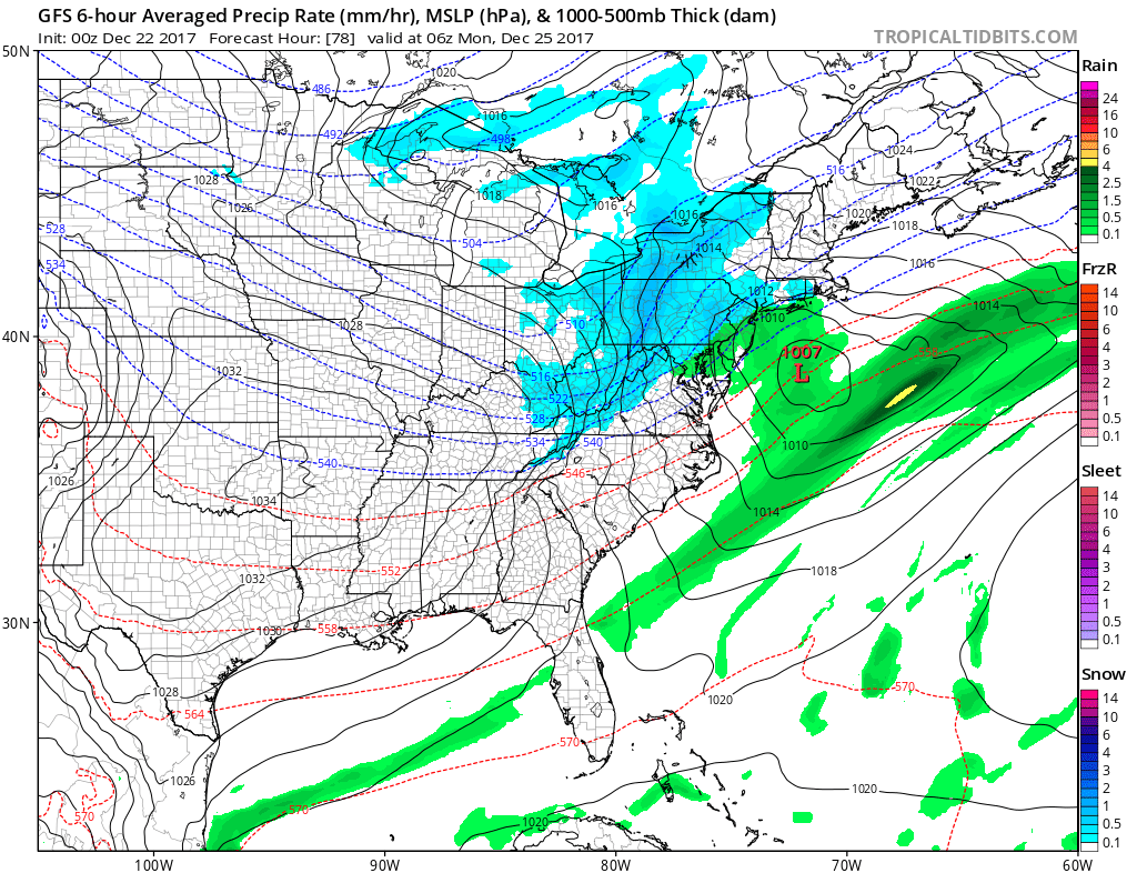
Yes, it is now trending with the much colder air moving in. An Arctic airmass will take shape into Christmas, but is now combining with moisture in the southern branch of the jet stream. This is cool, since now we have a resultant winter storm. Some of the wintry precip will fall around the mid Atlantic mountains and into the interior Northeast.
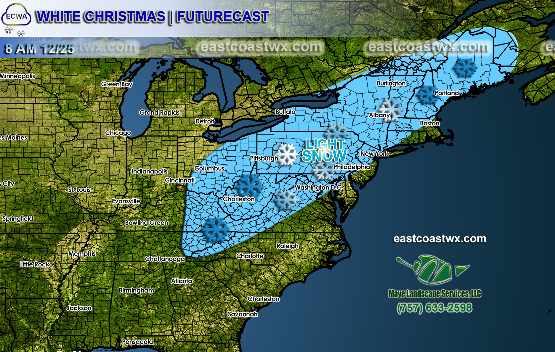
The first item of business that I want to throw your way is the latest graphic for a White Christmas. This is primarily a Northeast Corridor or I-95 storm. Nonetheless, folks here and up into New England will see an increased chance for flakes and dustings, maybe more in some locations.
Click for larger image
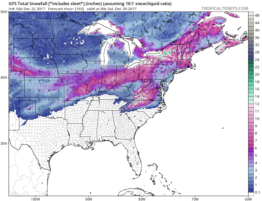
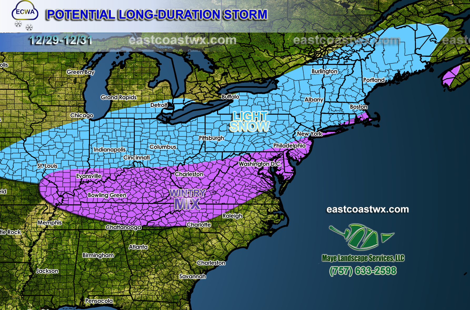
The next storm system to come through after this is on the 29th. This one has more of a threat for the Carolinas and Virginia in the form of freezing rain, sleet, and snow. Totals could be around an inch or 2 of snow plus a 0.5 inch of sleet. Glaze of ice is also possible in spots. I saw a suggestion today of snow to ice to rain back to ice. So the storm at the end of this month is very interesting.
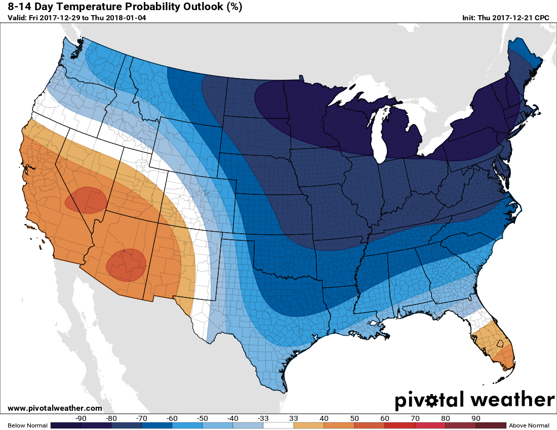
In the 8-14 day outlook from the CPC, they have much of the country in the deep freeze, especially far northern locations over the Plains. This is a signature of Arctic outbreaks. I would invest in some firewood or some alternative fuel source in case the power goes out. Look at how the cold spills into the Southeast! And into Texas. Incredible.
Click any image for larger! Thanks!
Latest graphic for the upcoming large-scale and long-duration winter storm, which includes snow and ice –
-Mike G.
You must be logged in to post a comment.