
There has been consistency in the model runs for the end of this month, around the 28th into the 30th. This trough of low pressure will likely be some kind of winter storm. Who gets what, where, and how much is still with low confidence.
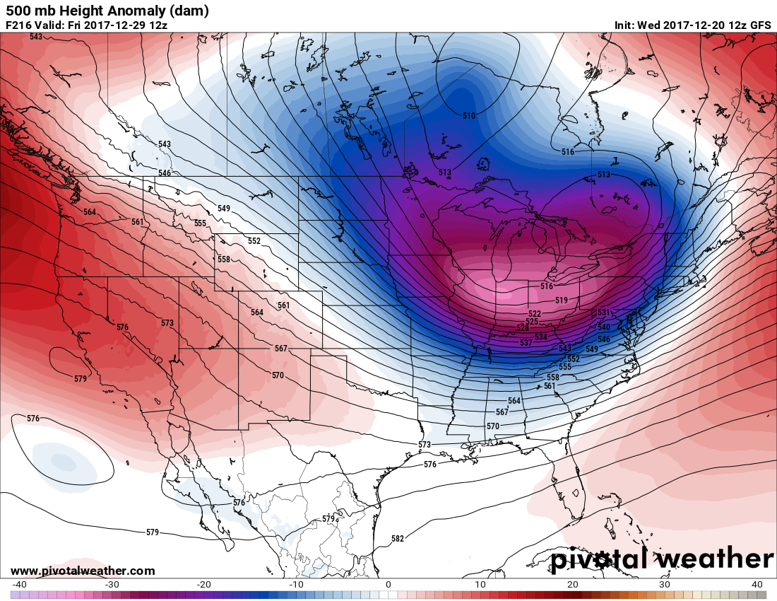
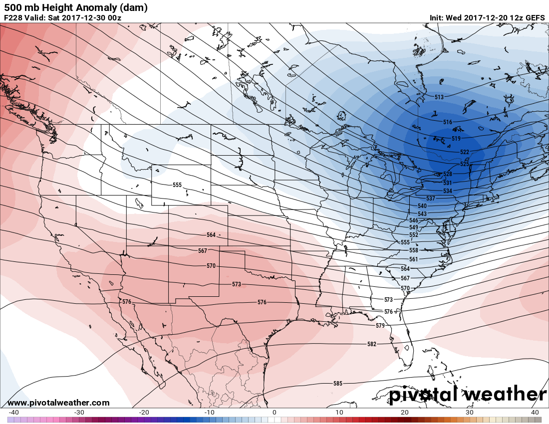
The GEFS ensembles are not as strong as the GFS deterministic model, however they are sniffing out some lower than usual heights around the 29th.
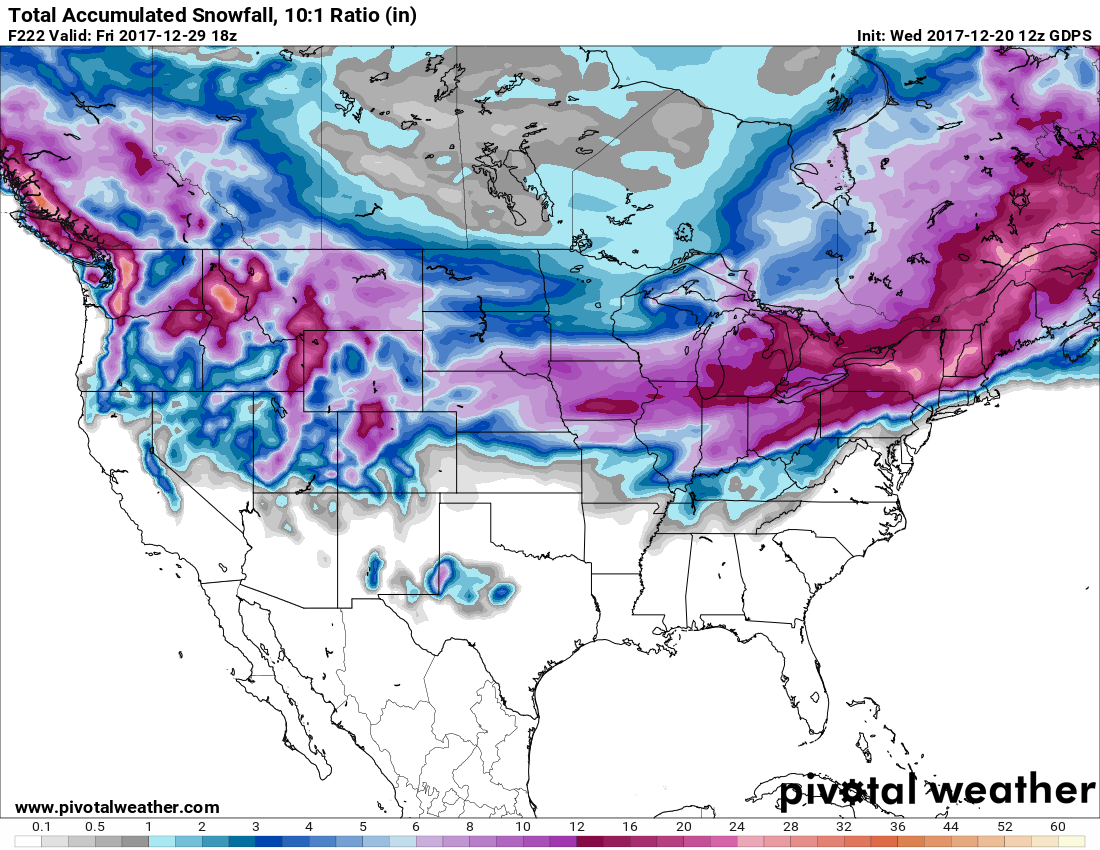
What are the latest modeled snow amounts? Have a look –
Here is the GFS and Canadian, both valid on the 29th:

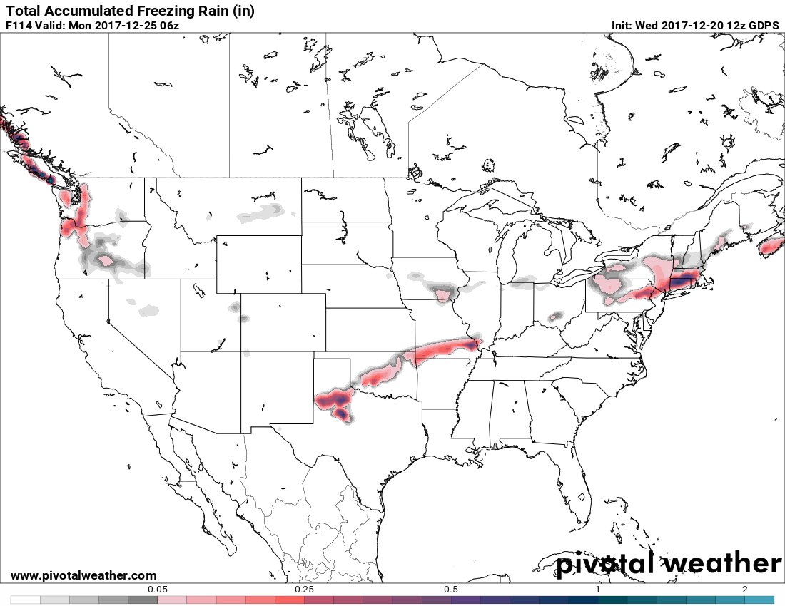
There is also some threat of ice from Christmas Eve 12/24 and into Christmas 12/25. The Canadian could be sniffing out some ice accumulations. The GFS (second) has much of New England under a threatening ice storm.

For more info and frequent updates please subscribe for a small monthly fee >>> https://carolinawxauthority.com/subscription-options
Mike G.
East Coat Weather Authority
Call 484-994-1027 for Snow Clients
You must be logged in to post a comment.