
CHRISTMAS 2017
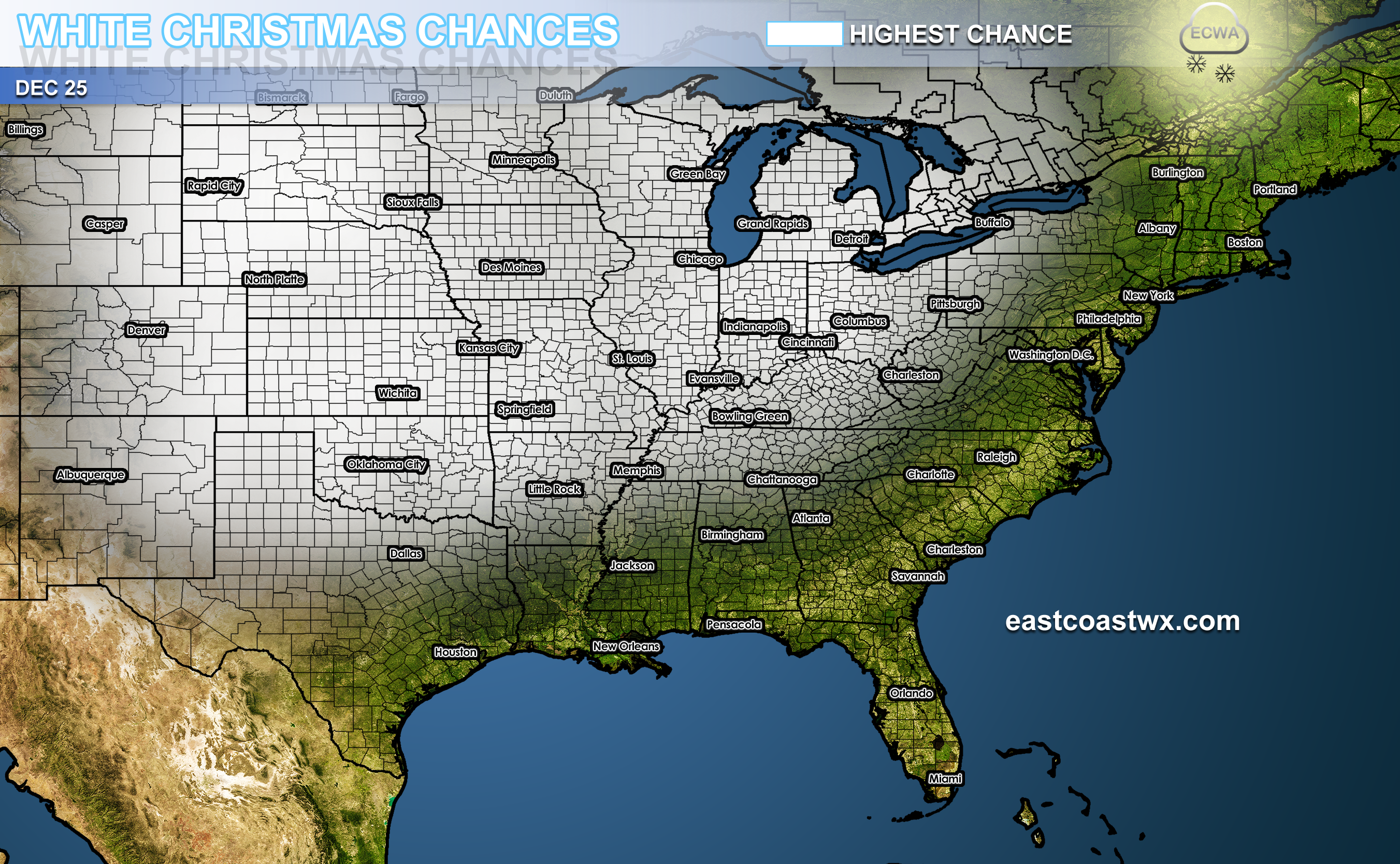
A very cold air mass is set to move in around Christmas Eve, and will become an active cold air mass on Christmas Day, the 25th. A shot of cold air coming down from Canada will deep freeze the northern US and also down into Texas. As far east as the Appalachians will see the highest chances for frigid temperatures and even a wintry mix.
There is uncertainty as far as how far east any wintry precip will extend. Temperatures will be marginal across the Southeast and even mild near the coast. However, with a very deep-digging jet stream, down into the Gulf Coast states, it is possible to get a drastic change in temperatures associated with a winter storm.
For now, it appears that the Plains down into Texas especially the Panhandle will see some kind of wintry precip. There still is the potential for an ice storm, however that is uncertain. The Appalachians may play a role in shielding the east from the wintry precip. This is not set in stone, and this situation needs to be monitored closely for changes.
Click for larger image
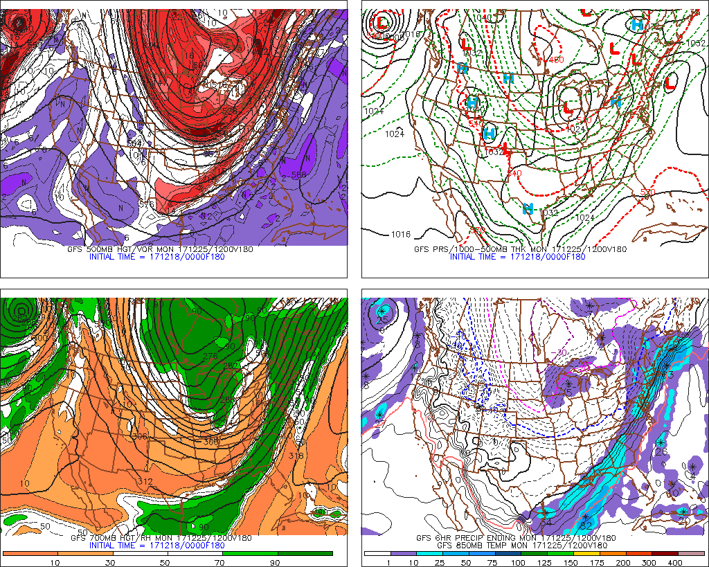
The jet stream is forecast to dig very deep into Texas on Christmas Day. Along with the jet stream will come disturbances that will cause wintry weather, including sleet and snow. The last time this happened on Christmas was 2010, when there was significant snowfall across much of the East Coast.
The top left panel is the jet stream and red is associated energy for storminess. There is a chunk of the Polar Vortex that will break off and park itself over the northern US. This would increase chances for snow for many people.
Stay tuned to the forecast especially if you have travel plans. There is a likelihood of travel delays and disruptions this year.
Become a member or subscribe today, contact Mike 484-994-1027. Or sign up here >>> https://carolinawxauthority.com/subscription-options/
For official forecasts please visit http://www.weather.gov
You must be logged in to post a comment.