
Currently we have our second nor’easter getting set to effect the Northeast, but what about the South? Will we get one more snowstorm to effect the southeast? Well right now the GFS is telling us to watch the beginning of next week.
By the beginning of next week we will have a trough in place along the east which includes the southeast.
GEFS 500mp Height Anomaly for 6z TUE March 13th, 2018:
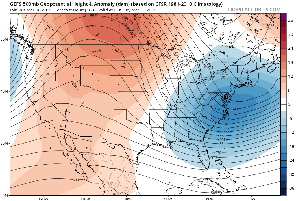
The trough in the east is a good indication that some kind of active weather will make it into the southeast, with the possibility of that active weather being precipitation. Also, for wintry precipitation we need cold to be in place.
GEFS 850hPa Temp Anomaly for 06z TUE March 13th, 2018:
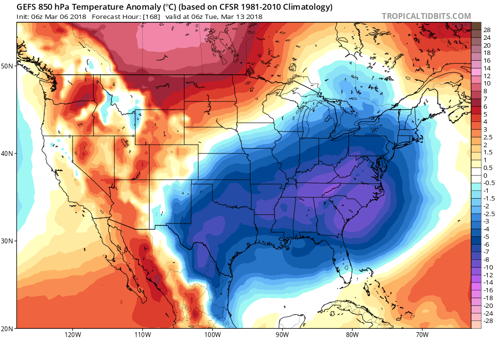
This shows that colder or below average temperatures are going to be in place along the east which again raises eyebrows for the potential of winter weather to effect the southeast especially the Mid-Atlantic and Carolinas.
GFS MSLP and P-Type for 00z TUE March 13th, 2018:
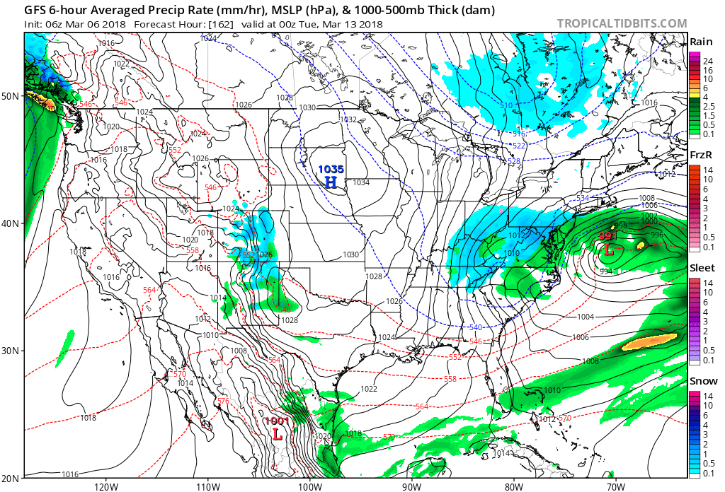
This is the operational GFS and as of the 6z run it does have wintry precipitation making its way as far south as Georgia. The pieces are there as of now for some snow to make its way into the southeast with cold temperatures and a trough over the region. Still about a week away, but definitely something to watch as we go forward. Continue watching the weather along with us here at East coast Weather Authority as we get you prepared for what mother nature has to bring!
-Alex B
You must be logged in to post a comment.