
We are a few day into spring and the east coast has been experiencing below average temperatures all month. Many people have been praying for winter to stop and their prayers may finally be answered. Well, unfortunately over the next few days it will remain cold for most of the region, however warmer spring like temperatures could be in store for next week.
Towards the end of the weekend the trough will begin to shift from south to north , and will move from Florida all the way to Canada by Tuesday.
GFS 250 Winds for 18z Tuesday, March 27 2018:
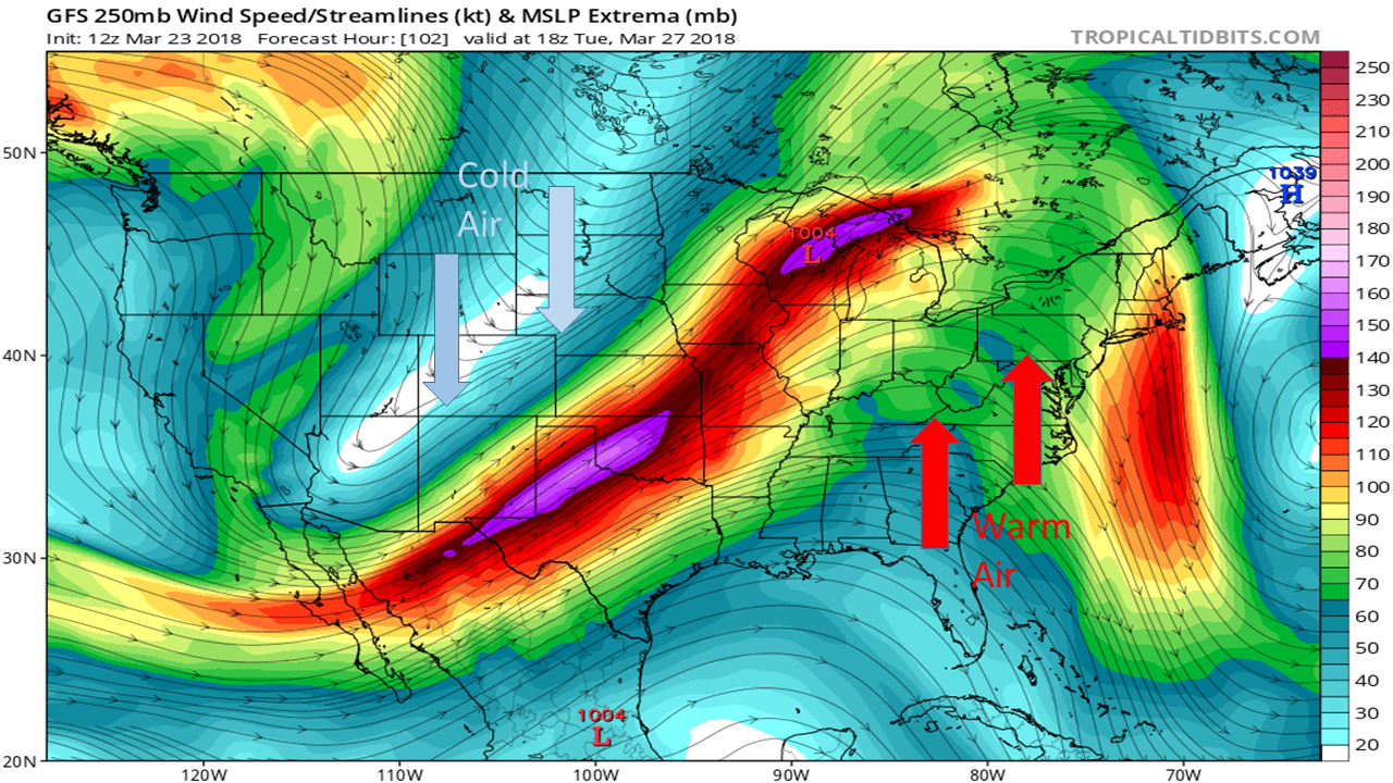
As you can see the jet stream dips to the south in the west allowing cold arctic air plummet to across the the region. This then results in a ridge in the northeast allowing warm air and more seasonable temperatures to effect the region. This warm moisture filled air will result in rain on Wednesday and Friday for most of the east coast.
GFS 2-meter Air Temperature for 18z Thursday, March 29 2018
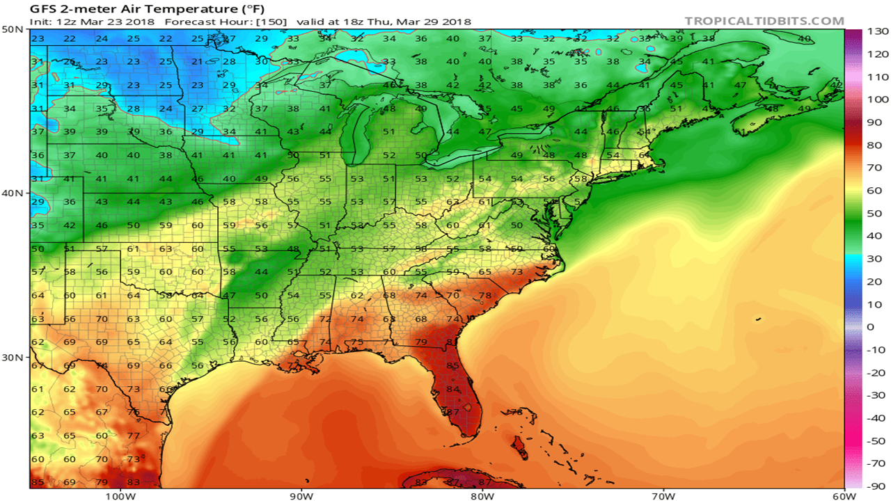
This is Thursday (March 29), notice how the very warm temperatures extend from Florida to North Carolina, most of this region will be experiences above average temperatures. As well the warm air will extend all the way through the northeast, these warm temperatures combined with rain can cause snow melt and possible flooding. This warm weather will persist for the rest of the week before cold temperatures return for the weekend. Stay here on East Coast Weather Authority and check for updates for the weather to come.
-Ben C.
You must be logged in to post a comment.