
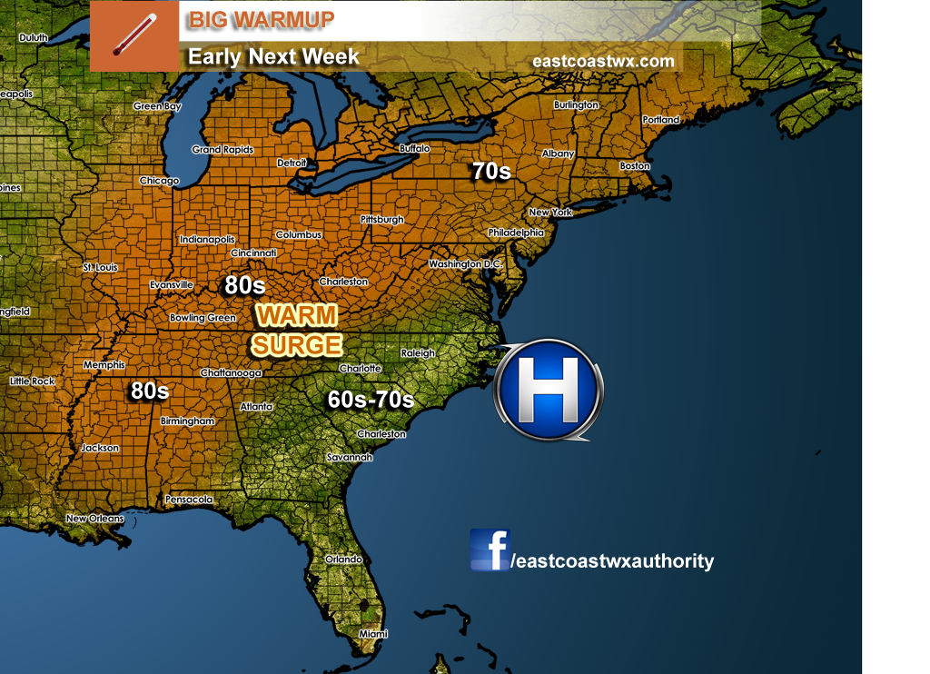
Who’s tired of the cold and rain? Some of us are, and don’t fret, since next week will finally feel better outside for most of us. A ridge of high pressure sets up just off the East Coast, and will pump in warm air for much of the Ohio and Mississippi River valleys into the Northeast.
The exception could be the Southeast, where showers will linger and will keep temperatures a bit cooler than normal. Temperatures may actually be warmer in the Northeast than the Southeast!
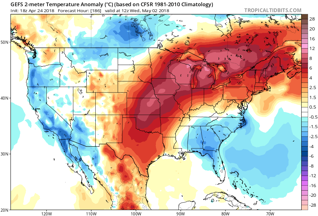
In Meteorology, we call this a “dirty ridge” which means that a ridge of high pressure is associated with showers and thunderstorms. This could be possible in the Southeast, as clouds and showers would keep us just below normal. Through the middle and late next week, things could progressively begin to warm up. However, Florida looks like they will remain slightly below normal.
The grass should start growing for many up North!
-Mike G.
You must be logged in to post a comment.