
It is late April and spring like temperatures are right around the corner however not before the eastern half of the country experiences one last cold snap, bringing well below average temperatures to much of the east coast. From Saturday into Sunday the northeast will be experiencing a low pressure system that will bring rain and possible snow in higher elevations. Following that low pressure system there will be a strong cold from sweeping across the east coast and an impending high pressure not far behind it.
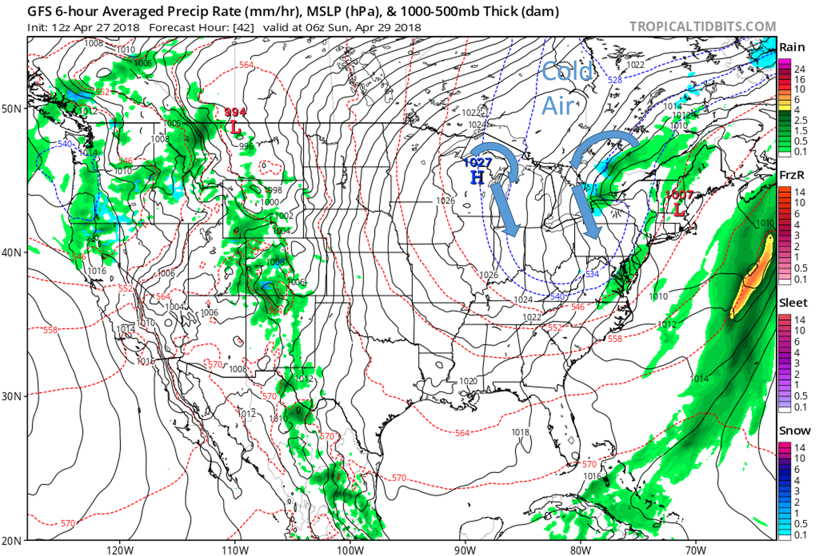
This allows the low and high pressure to make a joint effort to bring the cold air south. This is because low pressure systems spins counter clockwise wrapping the cold air around the backside of the storm, and high pressure systems spin clockwise so the front side of the high will experience cold air as well as seen in the graphic. Therefore allowing cold arctic air to plummet to the south.
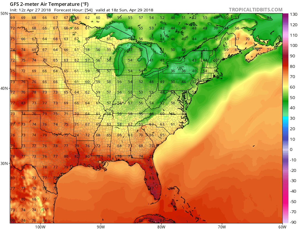
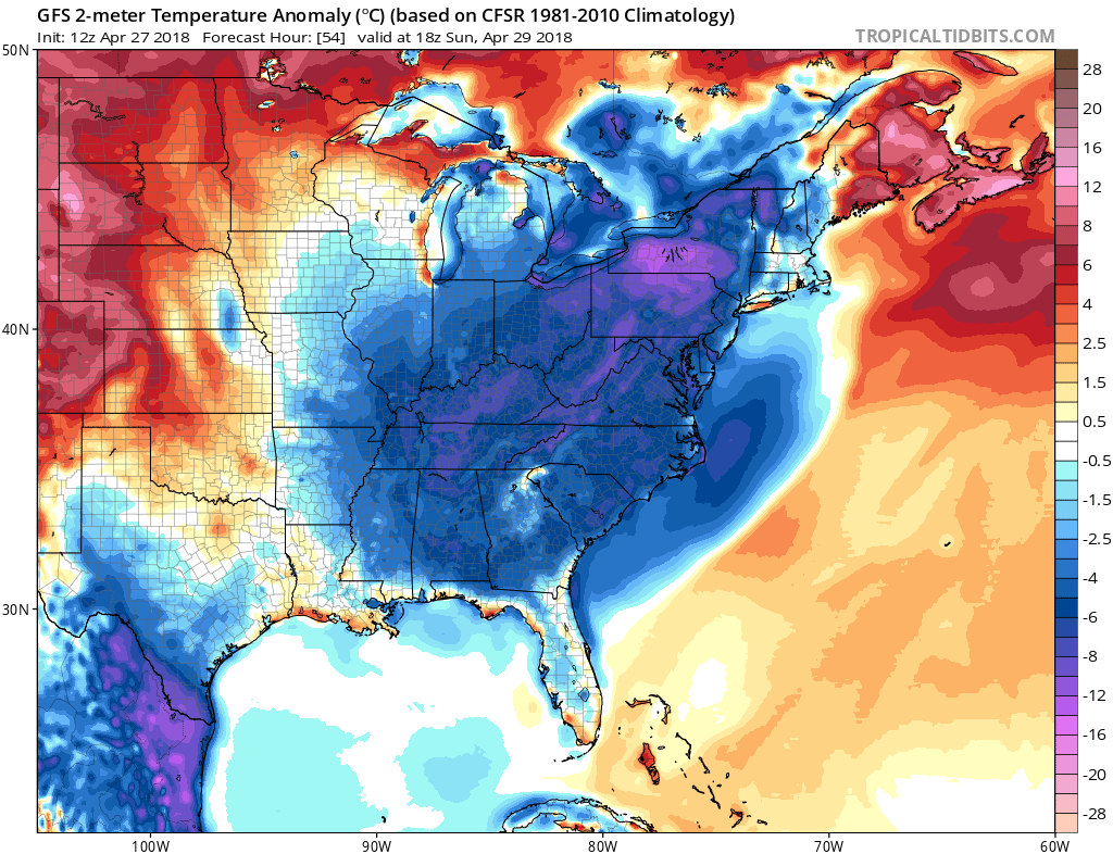
As you can see after the cold front moves through Sunday’s highs will be below nearly 10 below the seasonal average for this time of the year. Luckily this cold air wont stick around for some of us. The northeast will be getting above average temperatures in the 70s by midweek however slightly below average temperatures will stick around for the south east throughout the week. Stick with us here at East Coast Weather Authority to get the updates on weathers worst!
Ben C.
You must be logged in to post a comment.