
Yes, if it were the summer we would be experiencing a significant heat wave. It will continue to be warm this week, with highs in the 60s and 70s. Next week some locations (coastal) may even see 80 F! These are truly some unprecedented winters, with drier than normal (other than this year, it’s been raining) conditions, sunshine, and well above normal temperatures.
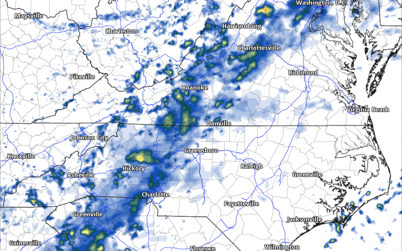
Above is the future radar for late night Thursday. There will be a line of storms moving in from the west, as this could be the remnants of severe storms out in Alabama on Wednesday and late Wednesday.
These storms could spin up, but data is too far out to know for sure. We will watch the SPC, or you will be able to here: spc.noaa.gov
Tomorrow (Wednesday) we will see the chance for some showers mainly locations just north. But there is a chance of drizzle anywhere in western/central NC Wednesday. Otherwise expect mainly dry for most if not all of the viewing area.
For now, enjoy the winter thaw (continued). That’s the end of the article, I meant continued warm.
Mike
You must be logged in to post a comment.