
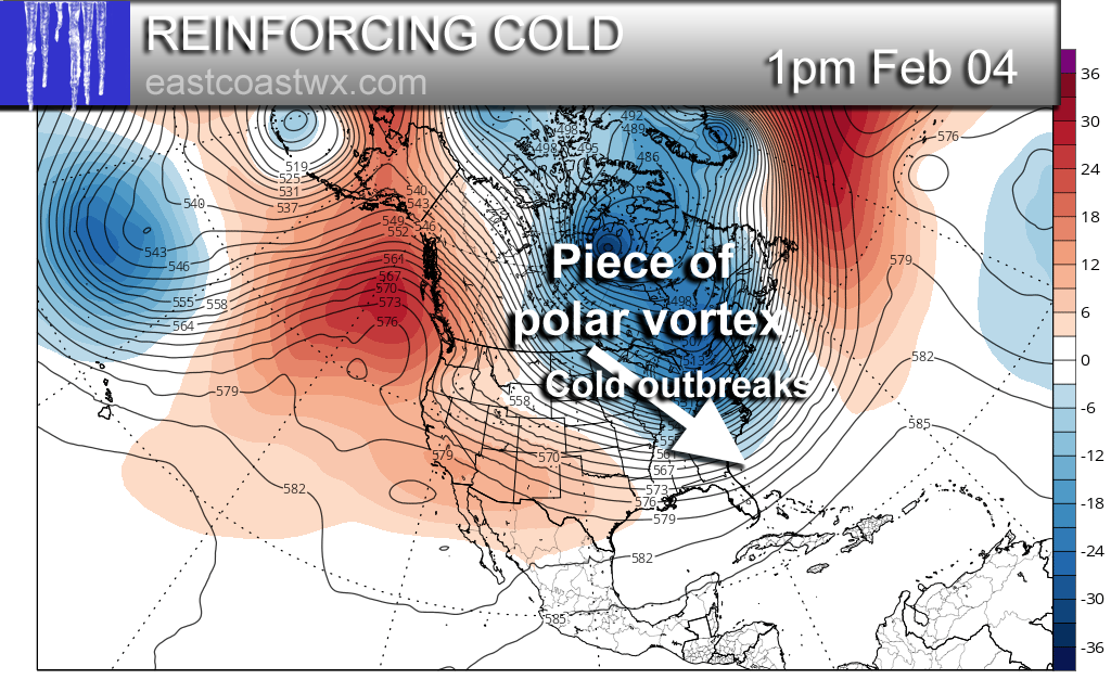
We will start seeing hints of below normal temperatures once again on or around the 30th. This will only be the initial first blast of cold air. More outbreaks will follow as a chunk of the Polar Vortex very high up in the atmosphere slides south over North America. This will bring our attention to another cold outbreak around the 3rd-4th. The GFS is shown below for 500mb height anomalies:
This is a pattern that is favorable for coastal storms including ones that ride up the coast, as we have seen previously. We think that the South is not done seeing wintry precipitation. Anytime from the 3rd to the 10th we can expect to have some kind of storm system along the coast, or even two. Details are not clear yet as far as timing or who gets anything or how much. With cold air in place, the pattern will become favorable.
If you liked this post, please hit the share button below to share with your friends.
-Mike G.
You must be logged in to post a comment.