
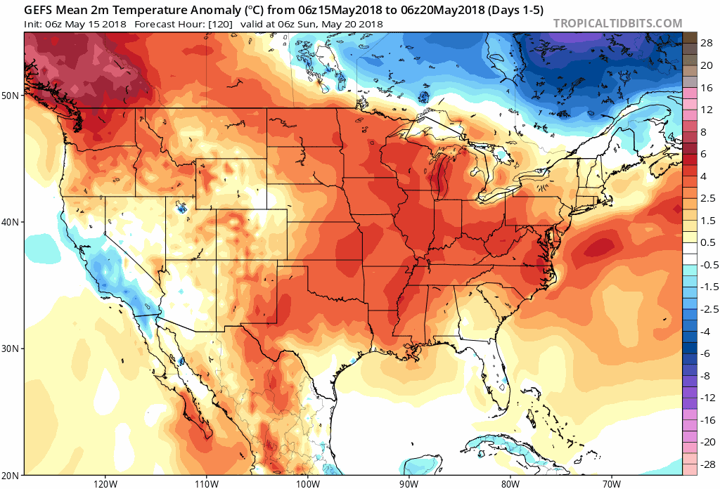
This month we have taken a jump from winter to sudden summer. Many places across the Southeast have broken numerous record highs in just the last week alone. The sweltering summer heat that is ahead of schedule will continue to bake the region until the end of the month.
Latest model guidance is showing the above average temperatures are to continue until the end of the month.
GEFS 2m Temperature Anomaly 5-day Average Loop from Days 1-5 Until Days 12-16:
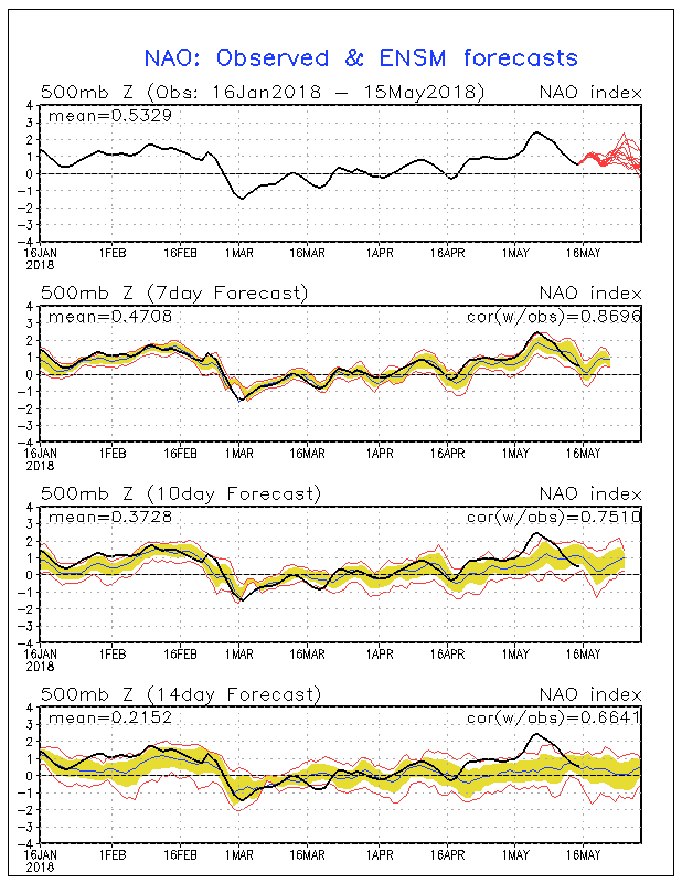
The heat that will end May is a direct result of a positive North Atlantic Oscillation (NAO).
NAO Observed & Ensemble Forecasts:
A positive NAO causes lower heights and colder temperatures over Greenland and above average temperatures to invade the Eastern US.
GEFS Mean 500mb Anomaly from May 15th, 2018 Until May 20th, 2018:
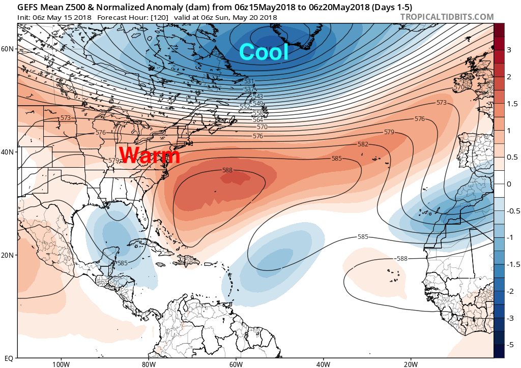
The above image is just for days 1-5 and the average is showing a classic +NAO with lower heights over Greenland and higher heights over the Eastern US. This pattern gives medium and long range forecasters confidence on what kind of temperatures will be on the way.
With the +NAO forecasted until the end of the month it gives me confidence when I say that the sweltering heat will continue until the start of June.
GFS 2m Temperature for SUN May 27th, 2018:
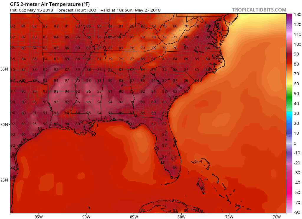
Above is a snapshot of temperatures for May 27th and even though this is over a week away I have confidence in that the sweltering heat will continue into the end of the month. Stay here with us at East Coast Weather Authority as we get you prepared for what the weather has to bring.
-Alex B
You must be logged in to post a comment.