
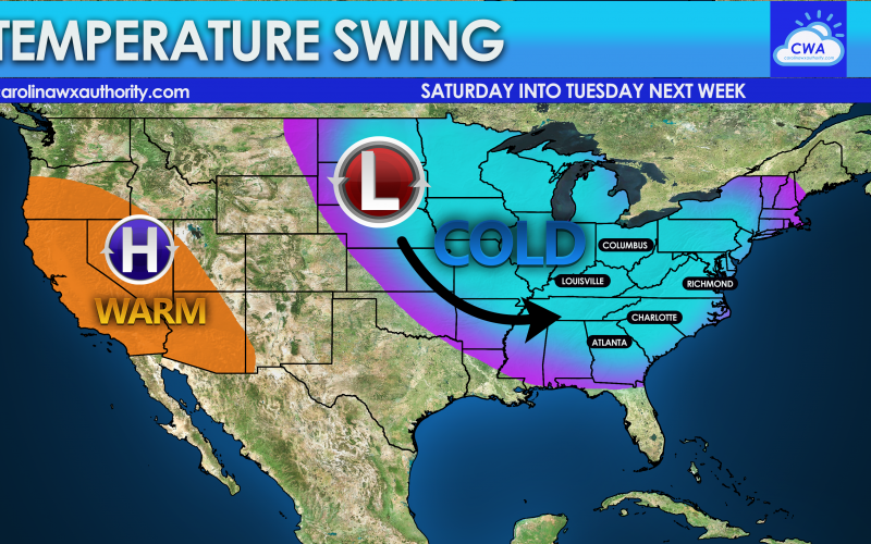
We will be warm this week with highs in the 50s, and some locations even in the lower 60s especially closer to the coast. It will be a pleasant next few days with dry conditions and plenty of sunshine. However, on Friday another storm system arrives and will bring with it a strong cold front. As this storm departs, it will wrap in colder air behind it, and a reinforcing shot of cold air will occur at some point on Sunday or Monday. However, this is not expected to be a sustained or long-lasting cold snap. Below is the temperature flip that we can expect on Saturday. This is not a Polar Vortex intrusion, and it will not be overly cold or too intense. It’s just a cold snap compared to the mild temperatures we will have this week.

During the coldest days of the cold snap, our morning low temperatures are not expected to be any colder than the low 30s. This could change however. But as of now, this is a widespread cold shot, but the intensity of the cold is not expected to be that great or intense. It’s just going to be colder overall compared to recent days, that’s all.

Does this come with a threat of snow? We are watching something that could happen on Sunday or Monday, but that is still too early for details. But it is our next chance, if we will have one.
As always, please share this article, thanks!
You must be logged in to post a comment.