
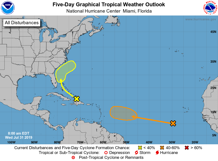
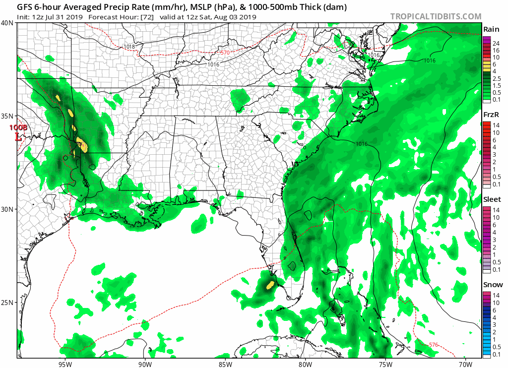
Invest 95-L which has kept our attention for several days, yet failed to increase to anything significant, is unlikely to change anytime in the near future. The National Hurricane Center leaves the chance of development into a tropical cyclone at around 10% as it reaches the Northwest Atlantic waters later this week into the weekend. The fruit of it’s labor has been, and will likely continue to be nothing more than a heavy rain producer as it tracks northward. We don’t expect full formation, but this weak tropical wave off the Southeast Coast may interact with some low pressure inland to enhance moisture and increase our chances of showers and thunderstorms going into this weekend, especially in more eastern locations. We can see that illustrated clearly in the 12z run of the GFS today:
We will keep an eye on this wave heading into the weekend and keep you updated of any changes. We’re also keeping an eye on a second disturbance farther out in the Atlantic which we’re slightly more concerned about. We will keep you updated of all the latest in tropical developments right here, as well as our Facebook and Twitter pages, so make sure to stay tuned.
Have a great Wednesday.
-Jesse
Carolina Weather Authority
You must be logged in to post a comment.