
A weak area of low pressure has formed over the northeastern Gulf of Mexico today, and development will be slow to occur as the low moves northeast into the Florida Panhandle then southwestern Georgia on Monday. However, once the low moves across eastern Georgia and South Carolina Tuesday into Wednesday morning, it could emerge into warm waters with a more favorable environment to develop into a tropical depression or storm Wednesday night into Thursday.
The next named storm on the list is Fay. As of this writing, Tropical Depression Five over the Central Atlantic will be soon upgraded to Tropical Storm Edouard before losing tropical characteristics Monday afternoon over cooler ocean water. Another tropical wave approaching the Lesser Antilles in a couple days probably won’t develop much more.
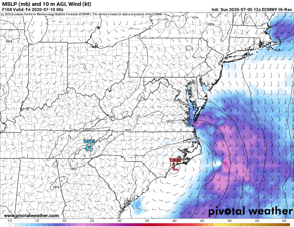
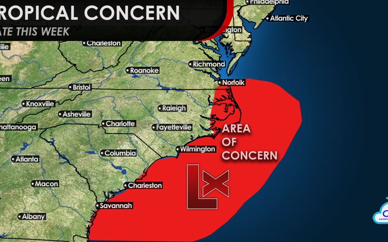
The European model has been most consistent in bringing the low just offshore North Carolina on Thursday, but stalling the system for 24 hours or so, which may give it enough time to slowly develop into a tropical storm. At that point, our biggest concern is for very heavy rain, especially along and to the northeast of the storm track. The stronger winds appear to move offshore and may just clip the Outer Banks and Mid-Atlantic coast. Perhaps that area of wind may move northeast and affect Long Island and coastal New England early next weekend, as our weather should quickly improve.
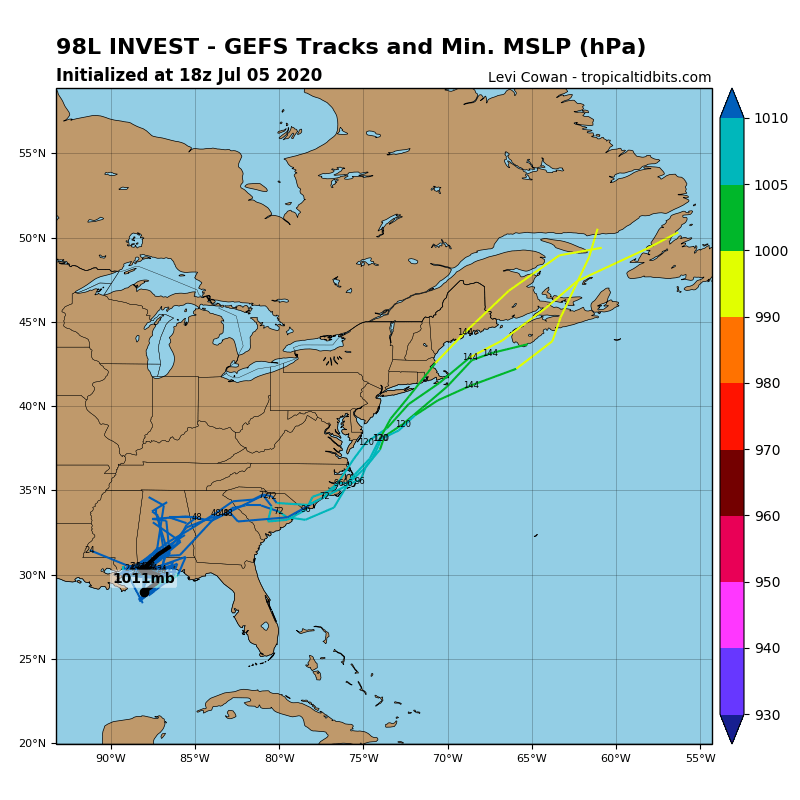
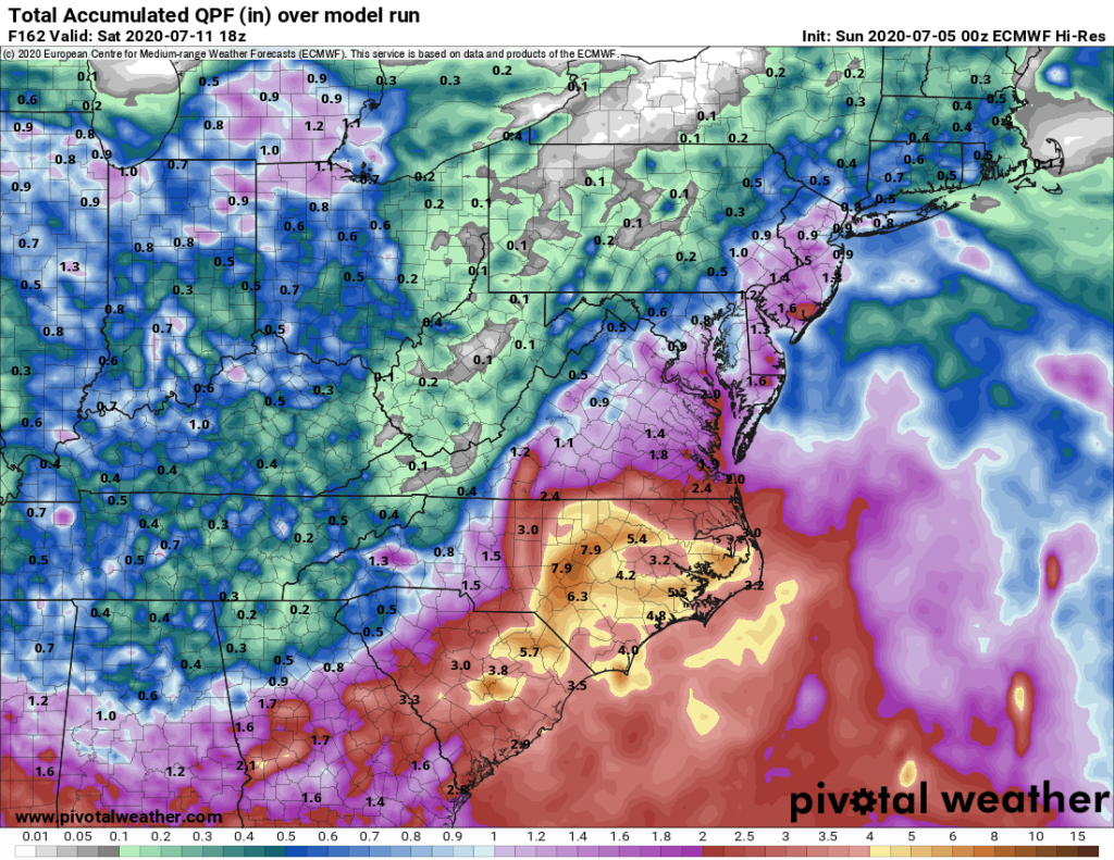
While the system is just in the formative stages, forecast models will continue to show uncertainty. However, the majority of ensemble solutions do take the system over South Carolina on Wednesday and near the North Carolina coast from Wednesday night or early Thursday through Friday. If it stays over land, it’s unlikely to get a name, but if it stays offshore, it may be our next tropical storm. Either way, a lot of rain on the order of 4-8 inches (locally more) is headed in our direction, in what has already been a very wet 90 days.
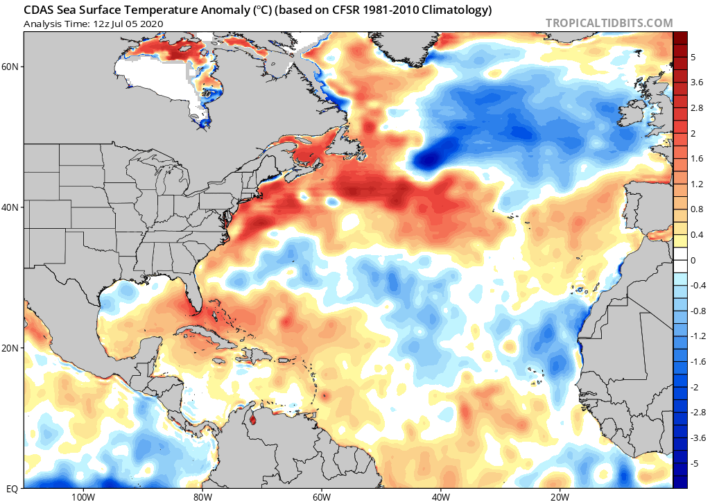
Ocean water temperatures do not favor rapid intensification this early in the summer, but notice how warm they are compared to normal off the Carolinas and especially the Northeast coast. This could be a harbinger for more intense storms than usual running along or just off the East Coast, with peak activity expected in September. After this system moves out, we will have to continue to prepare for additional storms, with CWA forecasting a higher than average chance for a hurricane (maybe a major hurricane) later this season.
Forecasts will continue to change quite a bit as this is system is still in the very early stages and will be back over land later Monday. Keep it tuned here for the latest!
-CWA
You must be logged in to post a comment.