
SEVERE STORMS LIKELY ACROSS THE SOUTH EARLY WEEK
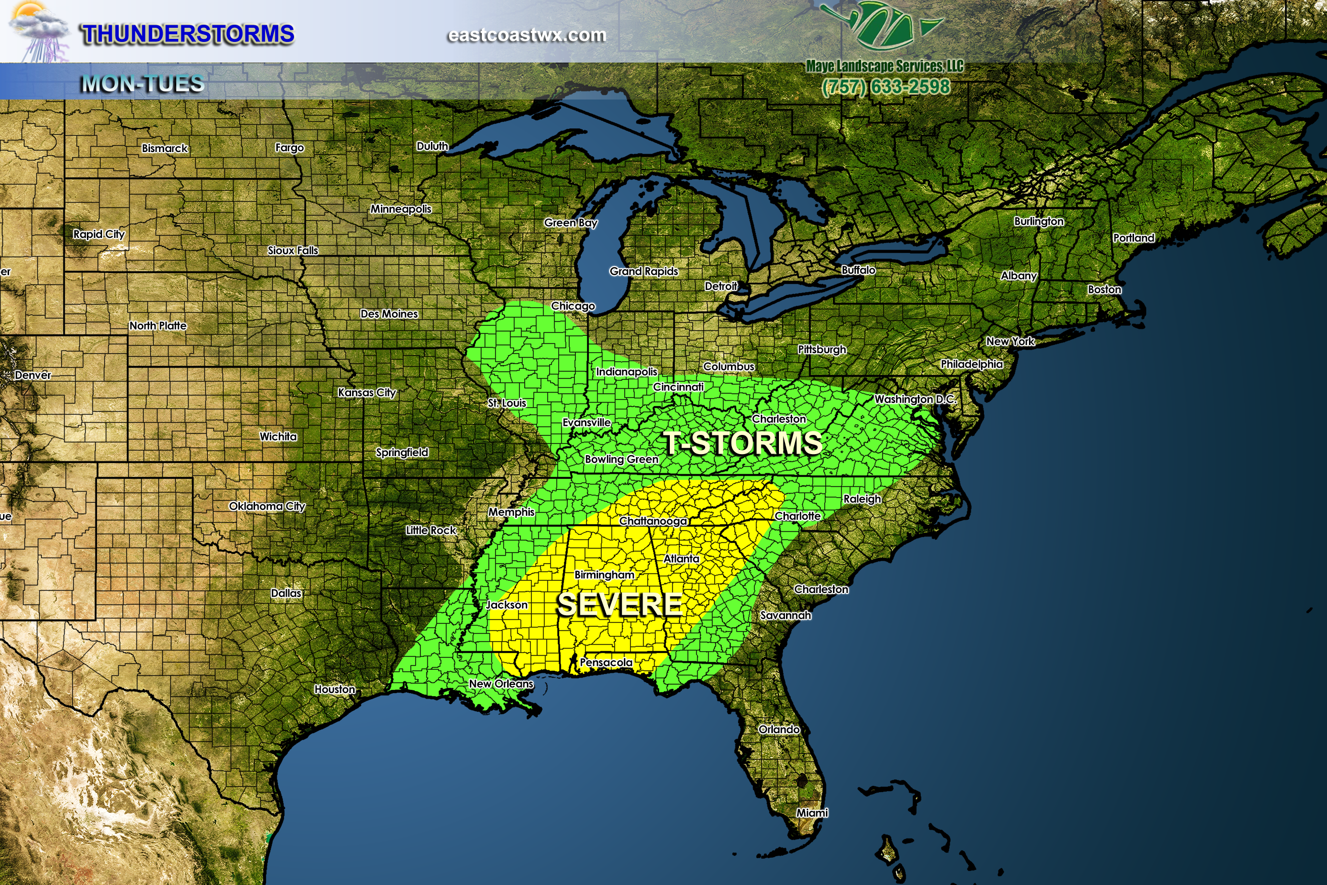
Thunderstorms will break out across the Southern Plains on Sunday. There could be some isolated tornadoes, however the main threat is damaging winds and hail. This threat will slowly push east on Tuesday into the South, including the Carolinas. We should expect to see some wind damage in spots, and perhaps a few random spin-ups as well.
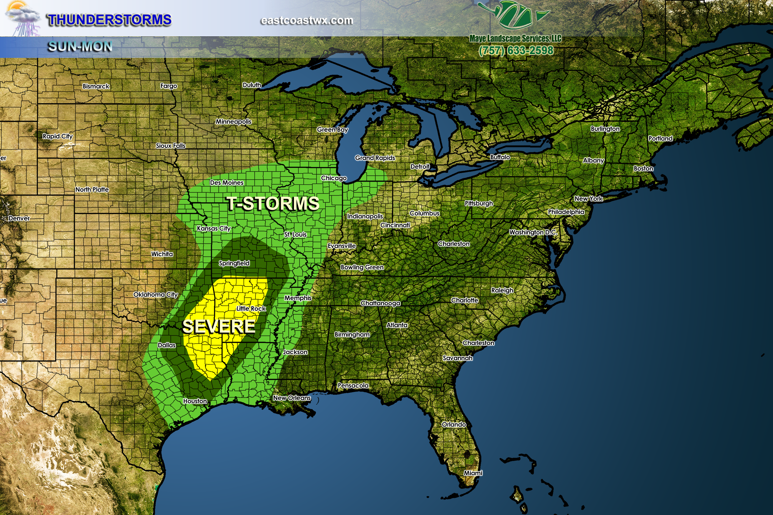
Storms could gain strength as they push east into a warm, humid airmass. If the temperature reaches the 70s on Tuesday, or even upper 60s, then we can expext to see a line of storms move in from the west that could take down trees. However, it is expected that any line coming from the west will weaken as it crosses the mountains. Still, the upstate of SC and the ATL could see some wind damage, and perhaps an isolated tornado.
Stay aware of the weather across the South for the next day or two. Keep your weather radios handy and have a source for weather watches and warnings. You may also visit our winter models page here on the site for the latest bulletins. Or visit your local NWS site.
The Severe in the 2nd image is not yet official, but we think it might be by the time Monday evening rolls around.
-Mike G.
FREE ROOF ESTIMATES
![]()
You must be logged in to post a comment.