
Sunday is a first weather alert day for our region, as a tornadic outbreak is possible. High wind shear values coupled with a cold front moving through Sunday night will set off the possibility for rotating thunderstorms. These could occur Sunday between 5-8pm for western NC, and the storms will track east towards Raleigh and eastern NC into Sunday night and early Monday morning.
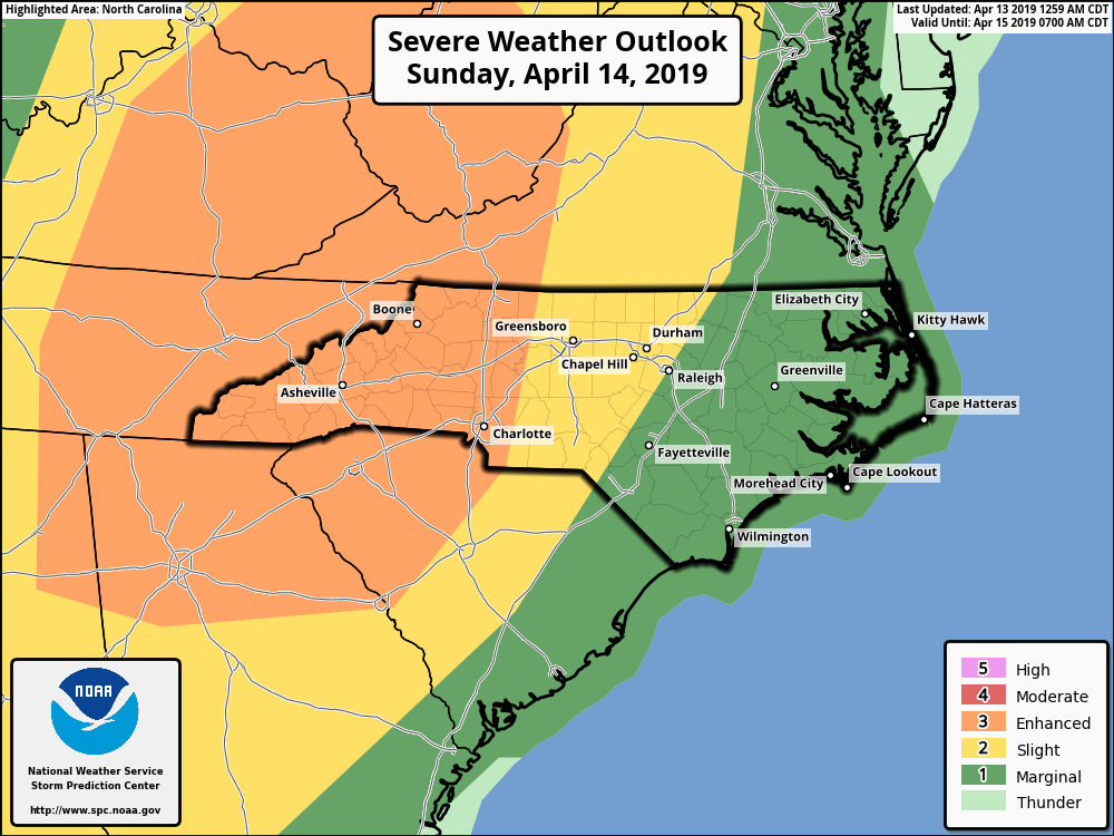
Significant tornado parameter paints Charlotte and western NC and SC into a moderate value. Again, this is between 5 and 8 pm Sunday.

The storms then move east into the the night towards Raleigh, and there could be rotating thunderstorms there as well around 2 am early Monday morning. The timing is not exactly known but it will be at night.

Tornadoes, damaging winds, and hail all are possible tomorrow! Have a way to receive weather warnings as an information source.
-ECWA
You must be logged in to post a comment.