
We are about to enter the busier times of hurricane season, and as we do, we will have a tropical feature to monitor off the Southeast Coast this coming weekend. Impacts may not be many for the Carolinas, especially if this disturbance remains weak. The only danger would be rip currents at the beaches. If this system does form, it will likely turn right away from the coast, however the exact track is not yet certain. The below is the Euro and is only one model run.
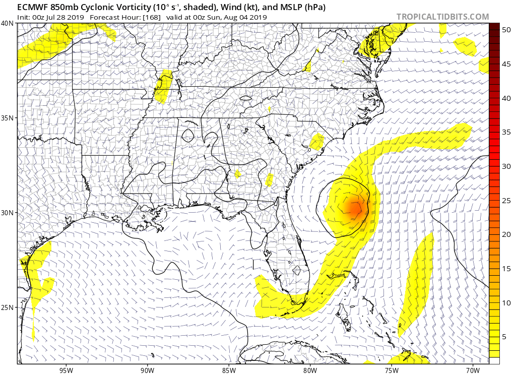
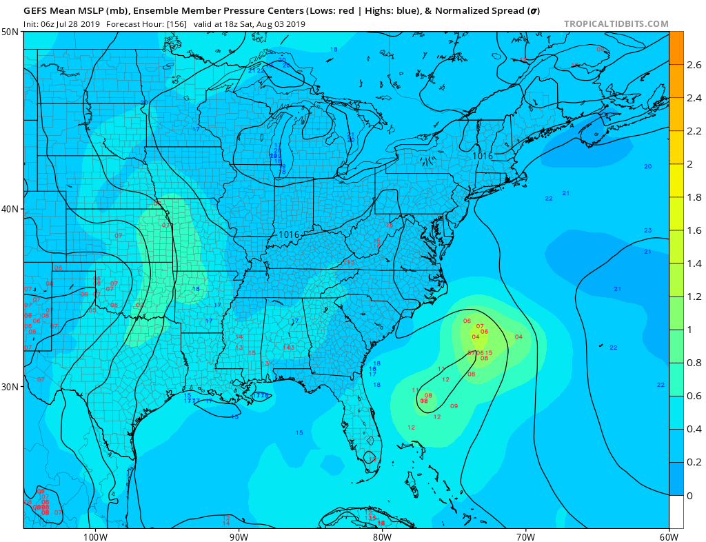
The GEFS ensembles keep most of the centers of low pressure offshore. Therefore this system may not have any impacts on land whatsoever, and this has been the trend. If Chantal does form, she will likely make the right turn after forming.
Anyone with travel plans to the Carolinas beaches this weekend should monitor the possible development of this tropical system. Do not cancel any plans just yet!
-Mike Griffith
Carolina Weather Authority Meteorologist
You must be logged in to post a comment.