
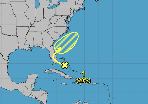
A weak tropical system with a 20% chance of formation will lurk off the Southeast coast later this week and this weekend. If a cold front comes along, or a trough from the west, this disturbance will be swept out to see and will no longer be a concern for the coast. The highest impacts will be some rough surf for the beaches and some heavy rains. Further development beyond a tropical depression is not likely, however this disturbance being upgraded to a tropical depression is certainly possible.
Currently global models do not make much of this system, as it could dissipate altogether. Just something to watch for now, and it’s early in the season! Let’s hope this isn’t a sign of the season to come. Again, we are not thinking this individual system is a cause for concern, other than for boating interests.
Download our NEW app and stay up to date this hurricane season! >>> https://carolinawxauthority.com/mobile-app/
You must be logged in to post a comment.