
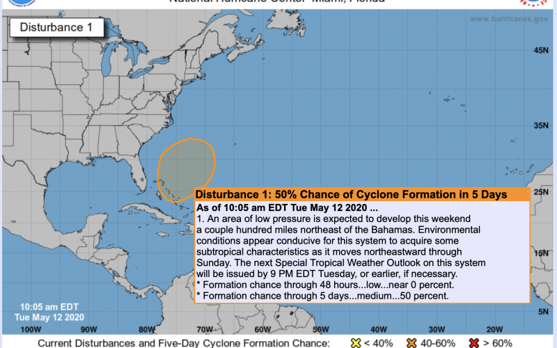
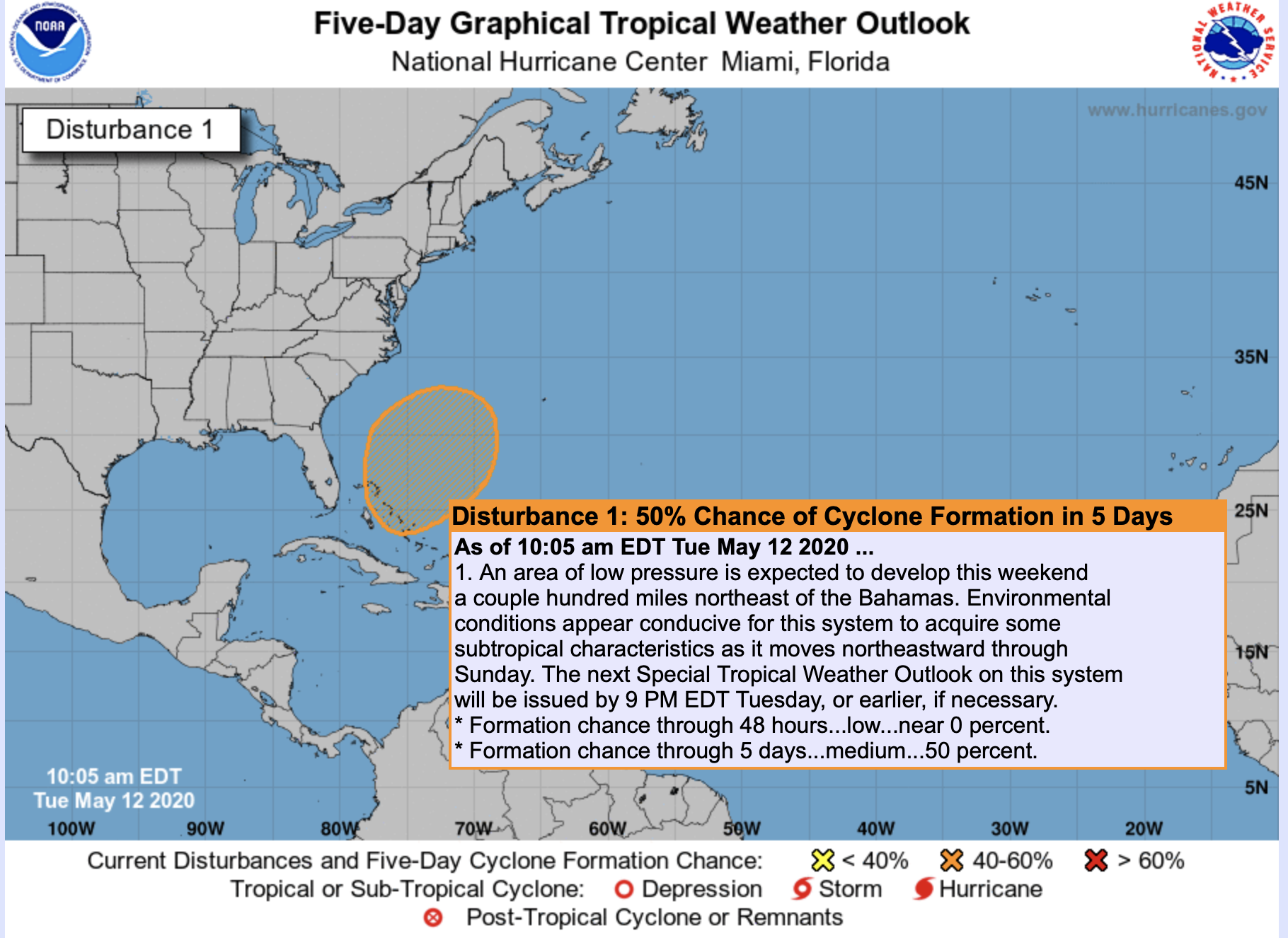
The NHC is monitoring an area of disturbed weather over the Bahamas, and give it a 50% chance of formation over the next 5 days. However, this is not something to be alarmed about, since the models take this system out to sea. It could get a name if it strengthens enough, and that name would be Arthur.
However, the biggest threats from this system appear to be torrential rains for the Bahamas. At this time, a maximum of a tropical storm is possible, and it might not happen until the system moves away from land. Or it could be a minimal tropical storm at best before finally moving out to sea.
There is presently no danger to the US coastline from this system. But the highlight is that it could kick off our 2020 hurricane season before the official start, which is June 1st.
You must be logged in to post a comment.