
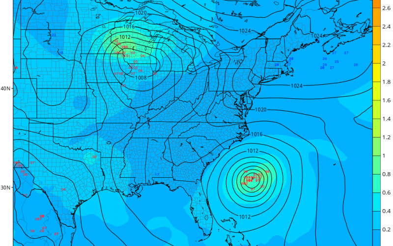
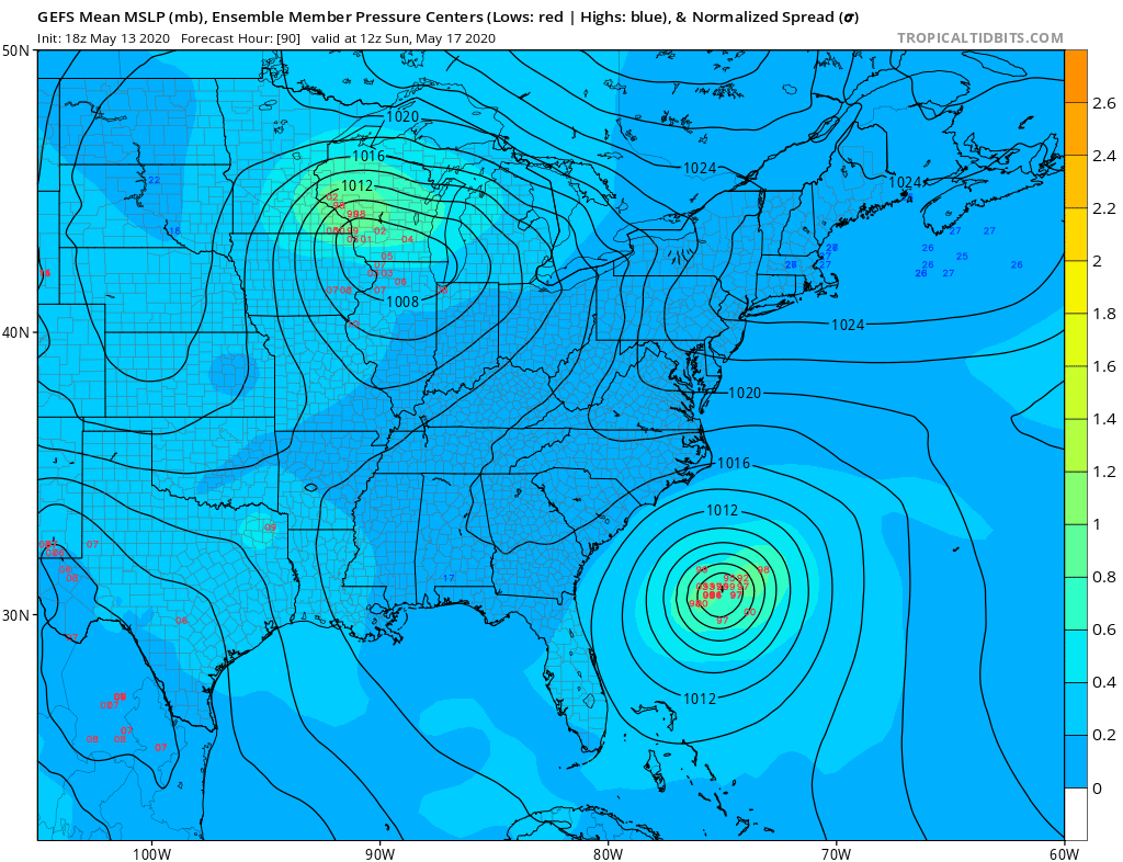
The 2020 Hurricane Season could be off to an early start if we get a named stormed with Arthur. An area of disturbed weather is expected to develop off the Florida coast later this week, and this weekend is when the system is expected to develop.
However, models are keeping this system out to sea and posing little threat to the US Mainland. It will however generate some decent waves along the SC and perhaps NC coastlines.
The GEFS ensemble low positions is shown below, or a scatter of expected centers of low pressure. Each red reading is a potential location for central low pressure for Sunday evening.
It is not clear what the strength of this system will be, but we suspect a weak tropical storm at the most. So it could be named Arthur and then pull away out to sea. This could be a sign of things to come for the rest of this season, and residents are urged to think of their hurricane evacuation plans.
You must be logged in to post a comment.