
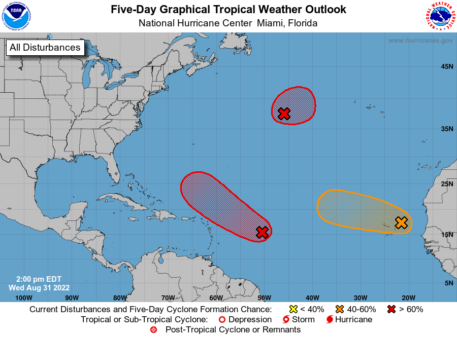
Fortunately for the Carolinas, Invest 91L seems to be heading out to sea on it’s forecast track over the Holiday Weekend. If the storm gets stronger then it’s chances of a recurve are higher (a turn to the northeast). Also, some waves are coming off of Africa and are only to be watched for now.
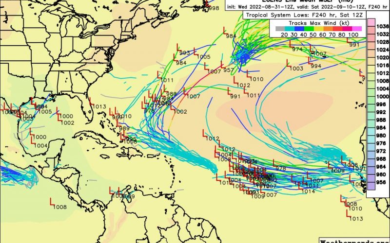
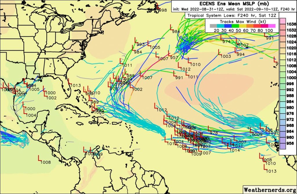
The Euro ensembles show the activity below west of Africa.
The NHC currently has one of the disturbances below in orange, which means a medium chance of formation. Note how the contour is kind of pointed to the northwest. So this system will likely be a “fish storm” or out to sea.
However, there is another wave behind this one, and is shown in the Euro tracks above. It’s too soon to tell, but we may need to watch this disturbance as well, over the next week or so, or beyond Labor Day.
It’s busy out there but currently nothing to worry about. Please check back, and share this article if you enjoyed it!
You must be logged in to post a comment.