
We are watching for the increased likelihood of a wave of low pressure forming off the Southeast coast. The exact track details have yet to be ironed out, however there are basically two option. Either a track farther out to sea, or along the coastline bringing heavy rains to SC, NC and eastern VA. The Outer Banks would also have rough conditions.
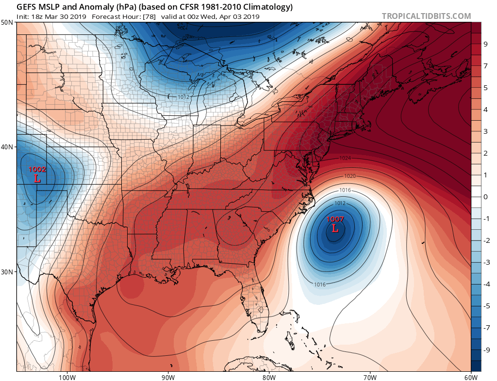
The Euro has this storm system well offshore next week. If it took this track, impacts to the coast would be minimal.
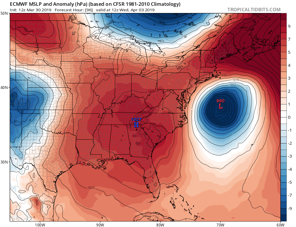
We will have to wait and see which track this storm will take as we get closer to Tuesday next week. For now, just a possibility!
-ECWA
You must be logged in to post a comment.