
SERIES OF COLD WAVES TO AFFECT EASTERN US
For the heat haters, there is good news for the upcoming week as more wintry weather looms. There will be a snow threat Sunday into Monday along the Mason-Dixon Line and into Philadelphia and north. Snow amounts will be covered in a later post, but the story is more cold comes after the snow.
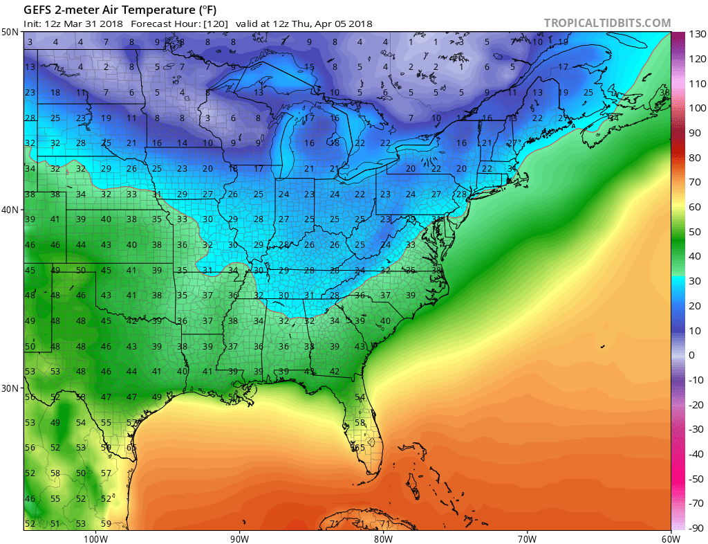
GEFS ensembles are pointing to a cold Thursday morning North, and a chilly morning South. Temperatures will average some 15 to 20 degrees F below normal. Shown are the departures from normal for Thursday the 5th:

Thursday 8am temperatures across the East Coast:
There will be warm surge ahead of this cold wave. Temperatures in the Southeast could reach the upper 70s before they come crashing down back into the 40s for highs.
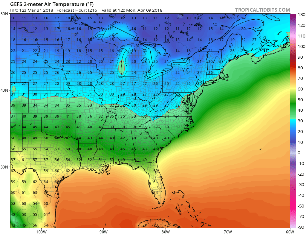
And there is more cold coming next Monday as well, as yet another cold wave arrives, bringing below normal temperatures to much of the East Coast once again. Temperatures will be below freezing in Philly and no more than 40 degrees F in the South.

Projected temperatures for Monday April 9th at 8am:
Outdoor plants and vegetation should be protected to avoid loss. Frost and freeze advisories may be needed. Fireplaces might still be needed!
-Mike G.
To sign up for our member emails, send an email to [email protected] to sign up! Just 5.50/month.
You must be logged in to post a comment.