
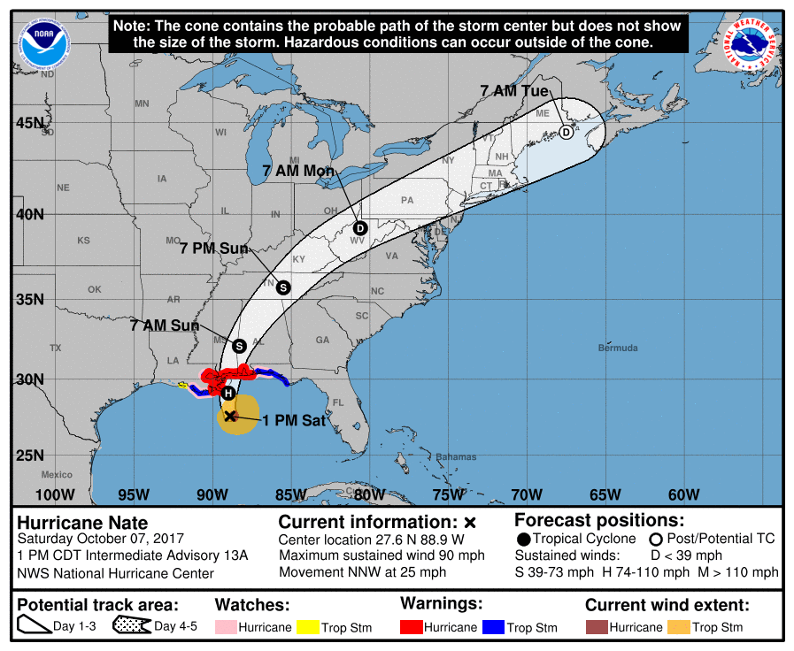
Nate will most likely make landfall tonight as a Category 2 hurricane along the Gulf Coast. Residents living along the coast near and east of New Orleans, and coastal Mississippi and Alabama need to hunker down for safety if you decided to stay. Conditions will rapidly deteriorate from this afternoon into tonight. Coastal and inland flooding, high winds with gusts to 95 mph, and power outages are expected. Please do not attempt to drive anywhere and consult your NWS for watches and warnings if you live in these areas. Stay in a room where you don’t think a tree will fall on the house.
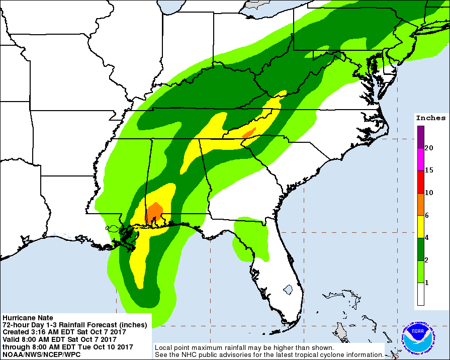
Heavy rain is expected to spread along the spine of the Appalachians tonight, as well as Sunday and into Monday. As a result, there will be flash flooding and poor driving conditions for many along the mountains. This area of rain pushes northward into Monday as the remnants of Nate spread out as rain for many areas. If you must go out, please use headlights with your wipers if you are driving during daylight hours for safety. It’s not the best idea to go out driving at night for the rest of this weekend.
Here are some expected rain totals from Nate issued by NOAA, these are for the next 3 days combined:
Stay safe and be sure to stay updated on Nate! There is also the threat for tornadoes as it is a landfalling tropical system. Don’t forget about the possible spin-ups. Anywhere to the east side of the storm is where we expect to see tornadoes. Keep your alerts active if you have them on your phone or weather radio.
Mike G.
You must be logged in to post a comment.