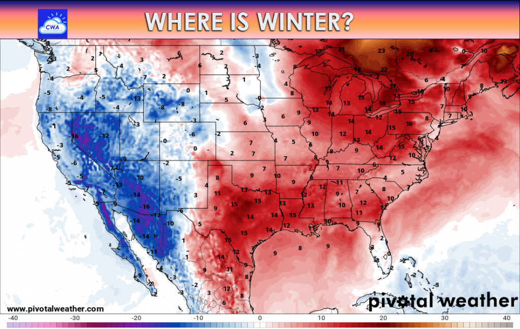
There is no doubt that we are in a snow drought this year along the East Coast. That trend does not look to break anytime soon, unfortunately for snow lovers. For everyone else that wants warm, this is your winter so far. There is no sign of cold yet, but that *may* change later this month.

The Next 7 Days Ahead:
Thursday: A squall line of wind-driven rain and storms moves across the coverage area. There could be some embedded tornadoes but mainly across western SC. But this line will have to be watched as it moves east across the Carolinas. Any outdoor decorations should be taken inside.
Friday: Much colder as the day goes by, and windy. Mountain snow showers are likely. The sun will be out, and it will get cold before sunset.
Saturday: All in all a cold and sunny day. Light winds, Nothing too eventful. Any mountain snow showers should taper off as high pressure settles in.
Sunday: Another bright and sunny day, but temperatures should start to warm up once again. Light winds.
Monday: Clouds may increase as rain approaches from the west. There may be some light drizzle in western locations.
Tuesday: Rain moves in by morning, and moves from west to east across the coverage area. Rain should taper off from west to east. It will be a mild rain and will not feel like winter.
Wednesday: Sunny and colder. Light winds.
Thursday: Another system approaches from our west bringing scattered showers. Not everyone gets wet. Temperatures still remain mild.
There is no snow in the next 7 days other than the mountains Thursday into Friday. There could be some cold air moving in around the 22nd or so, but confidence is very low. We may remain warm through the end of the month, or perhaps drop down to normal at times.


You must be logged in to post a comment.